-
River and Park Access and Closure Information
- Lewisville Park - The boat ramp at Lewisville Park is open but the boat ramp at Daybreak Park is closed to storm damage.
- Daybreak Park Boat Ramp - Daybreak boat ramp is closed to due to storm damage from the December 2025 high flow river event until further notice. Please check the Clark County Public Works website for updates.
- Lower Daybreak Park - Restoration along the trail at Lower Daybreak Regional Park will begin late summer 2026. During that time, Lower Daybreak will be closed. Upper Daybreak will remain open.
- County Yard - Access to the river from the county yard is restricted.
- East Fork Lewis River Greenway Trail/Danger Park - Access to the river and to Danger Park/East Fork Lewis River Greenway Trail is restricted.
- Bjur Road - access to the river from the Bjur Road gate area is restricted.
- Cemetery Bend - access to this fishing/recreation area is restricted.
About the East Fork Lewis River Reconnection Project
The East Fork Lewis River Reconnection Project is a $23.5 million habitat restoration, flood and erosion risk reduction, and recreational enhancement project. The project spans over three river miles along the East Fork Lewis River from Lower Daybreak Regional Park to Cemetery Bend. Construction crews with Tapani Inc. and Aquatic Contracting broke ground in April 2025 and construction will last until October 2026.
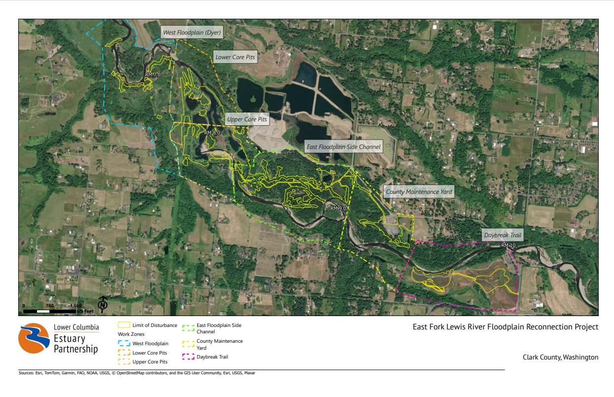
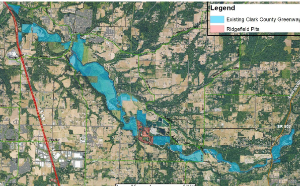
The East Fork Lewis River Reconnection Project includes lower Daybreak Park, a Clark County maintenance yard, the East Fork Lewis River Greenway/Danger Park, the Ridgefield Pits, and Dyer Creek. A map of the project area is below.
East Fork Lewis River Reconnection Project details
Every section of the East Fork Lewis River is unique; below is a list of the site-specific targeted actions that will achieve the projects goals of habitat restoration, flood and erosion risk reduction, and improved recreation. Click here to view a full-size project map.
-
Project Actions: Lower Daybreak Park
- A portion of Daybreak Trail and a utility pole will be relocated farther away from the river to reduce erosion risks.
- A floodplain bench will be graded down along the riverbank to increase flood storage in the area and create additional floodplain habitat.
- Wood structures will be installed along the bank to help reduce erosion risk.
- Native trees and shrubs will be planted to stabilize the eroding shoreline and provide wildlife habitat.
-
Project Actions: Clark County Maintenance Yard
- A portion of the County Yard is currently within the 100-year floodplain, this area will be relocated to higher ground next to the road.
- The southern portion of the County Yard will be restored to floodplain habitat, creating additional flood storage and habitat for salmon during high flows.
-
Project Actions: East Fork Lewis River Greenway/Danger Park
- An abandoned gravel pit will be filled to create functional floodplain habitat that will provide off-channel areas for juvenile salmonids to rest during high flows.
- A portion of the side-channel to the south of the abandoned gravel pit, and in the area around the confluence of the East Fork Lewis River, will be improved to provide greater habitat quality and quantity.
-
Project Actions: Eastern Floodplain/Upstream of Ridgefield Pits
Over 3,000 feet of new channels will be created downstream of Danger Park on the Eastern Floodplain. Habitat features will be installed in the channels and the new channels will provide additional pathways for flows compared to existing conditions.
-
Project Actions: Ridgefield Pits
- The floodplain adjacent to the river will be re-graded and the cobbles and dirt will be used to fill the Ridgefield Pits and reconstruct a multi-channel system through this river reach. This will help reconnect the river to the floodplain during high flow events.
- Three new channels will be constructed to restore the multi-channel network that existed prior to development in the valley. These channels will bring additional flow to the floodplain, helping to recharge groundwater, provide cool water for salmonids during warm summer months, and reconnect the existing wetlands to the river.
- Large wood structures will be placed along the riverbanks and instream to reduce erosion potential and provide resting places for migrating juvenile salmon.
- Native trees and shrubs will be installed to increase the riparian buffer and help shade the small side channels, reducing the high temperature impacts.
-
Project Actions: Dyer Creek
- The channel connecting Dyer Creek to the East Fork Lewis River will be re-graded to correct the water depth and high flow velocity issues that prevent juvenile salmon from accessing Dyer Creek. This action will reestablish the connection between Dyer Creek to the East Fork Lewis River that was severed in the 1970s.
- A small, undersized culvert will be removed and replaced with a larger box culvert that, and two other culverts that are not functioning properly will be removed, to allow fish passage between two sections of Dyer Creek.
Year 1 Construction highlights and information
2025 was the first year of this two year construction project. A lot was accomplished! Below is a list of highlights from the first year of the East Fork Lewis River Reconnection Project.
Watch the two minute recap video of the first year of construction and check out the more detailed project updates in the drop-down section below.
-
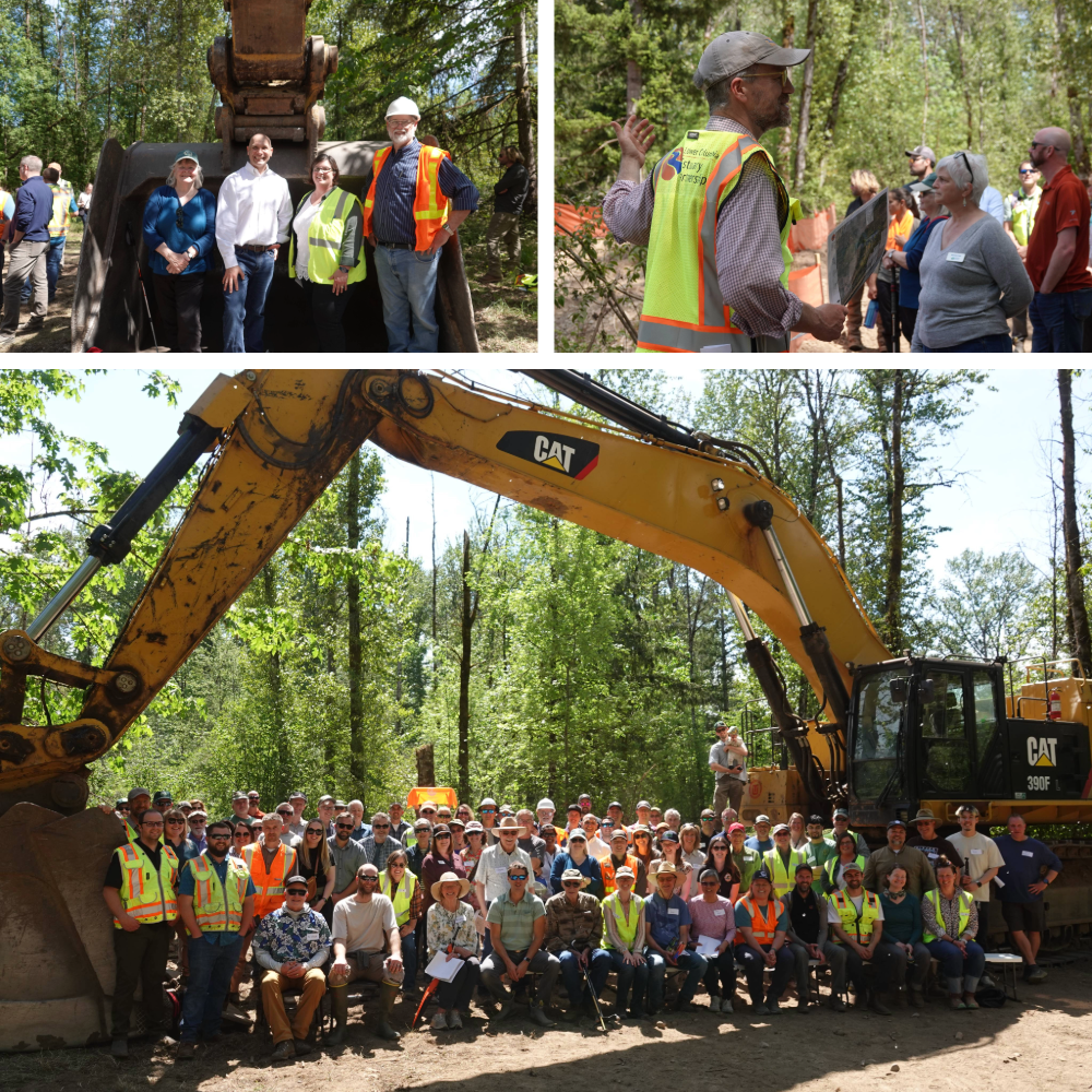
Groundbreaking celebration held on May 9, 2025
More than 100 people gathered at the East Fork Lewis River Reconnection Project site to celebrate the beginning of construction. The event included remarks from Clark County Councilor Sue Marshall, Washington State Representative Peter Abbarno, Kevin Tapani, co-owner of Tapani Inc., and Elaine Placido, Executive Director of the Estuary Partnership. Project tours were provided to celebration attendees by Estuary Partnership staff.
-
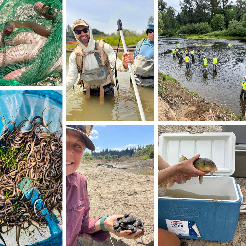
Aquatic rescue and relocation efforts
Before the restoration work could begin, the fish and wildlife within the construction area had to be rescued and safely relocated to suitable nearby habitat. The rescue and relocation efforts were a massive undertaking involving diving, snorkeling, netting, and low-grade electro-shocking, plus a lot of digging by hand!
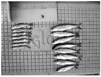
More than 81,000 juvenile lamprey, 45,000 freshwater mussels, 46,000 fish (including juvenile salmon, native largescale suckers, and sculpin), and more than 50 native painted turtles were relocated from within the project boundary. The rescue efforts yielded a significant number of warmer-water fish who prey on juvenile salmon and thrive in the pond-like conditions of the river that the project aims to eliminate.Over 2,000 volunteer hours were logged during the fish, lamprey, mussel, and painted turtle relocation efforts that preceded in-water construction in each pit! If you missed out on the fun, join the East Fork Lewis River Reconnection Project mailing list to learn about opportunities during Year 2 construction.
-
Temporary diversion dam built
A temporary diversion dam (coffer dam) was installed at the end of June to divert the mainstem of the East Fork Lewis River into a newly constructed side channel and around the Ridgefield Pits that were the focus of Year 1 restoration activities. With the river flowing around the project site, construction crews began pumping water from the pits so they could be filled and restored. Watch a timelapse video of the diversion dam being constructed to divert the mainstem of the East Fork Lewis River.
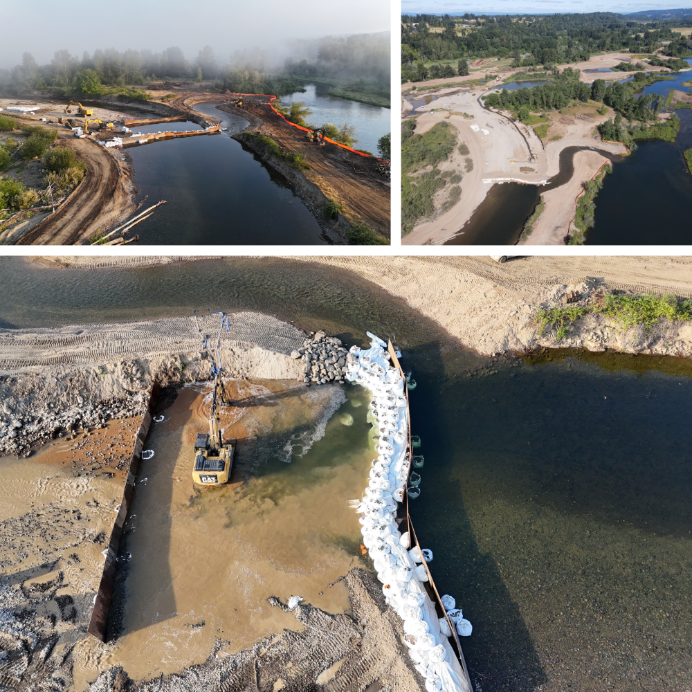
photo credit for the top left and bottom image: Kurt Cichosz
-
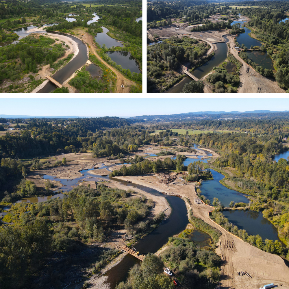
Four former gravel pits filled
After the diversion dam redirected the river, crews got to work filling four former gravel pits, reconnecting the area to its former floodplain, and recreating the historically braided river system by building side channels, alcoves, and wetland habitat.
The top left image is of the East Fork Lewis River Ridgefield Pits area prior to floodplain reconnection in June 2025 (the bridge was installed to provide temporary access for construction workers); the top right image is the project site in August 2025, the river is diverted to four former gravel pits are filled; the bottom image is from November 2024 after diversion dam was removed and the river began flowing through its newly restored, braided floodplain. The former gravel pits on the right side of the image will be restored during Year 2 construction.
Watch a video flyover of the newly restored and reconnected floodplain.
-
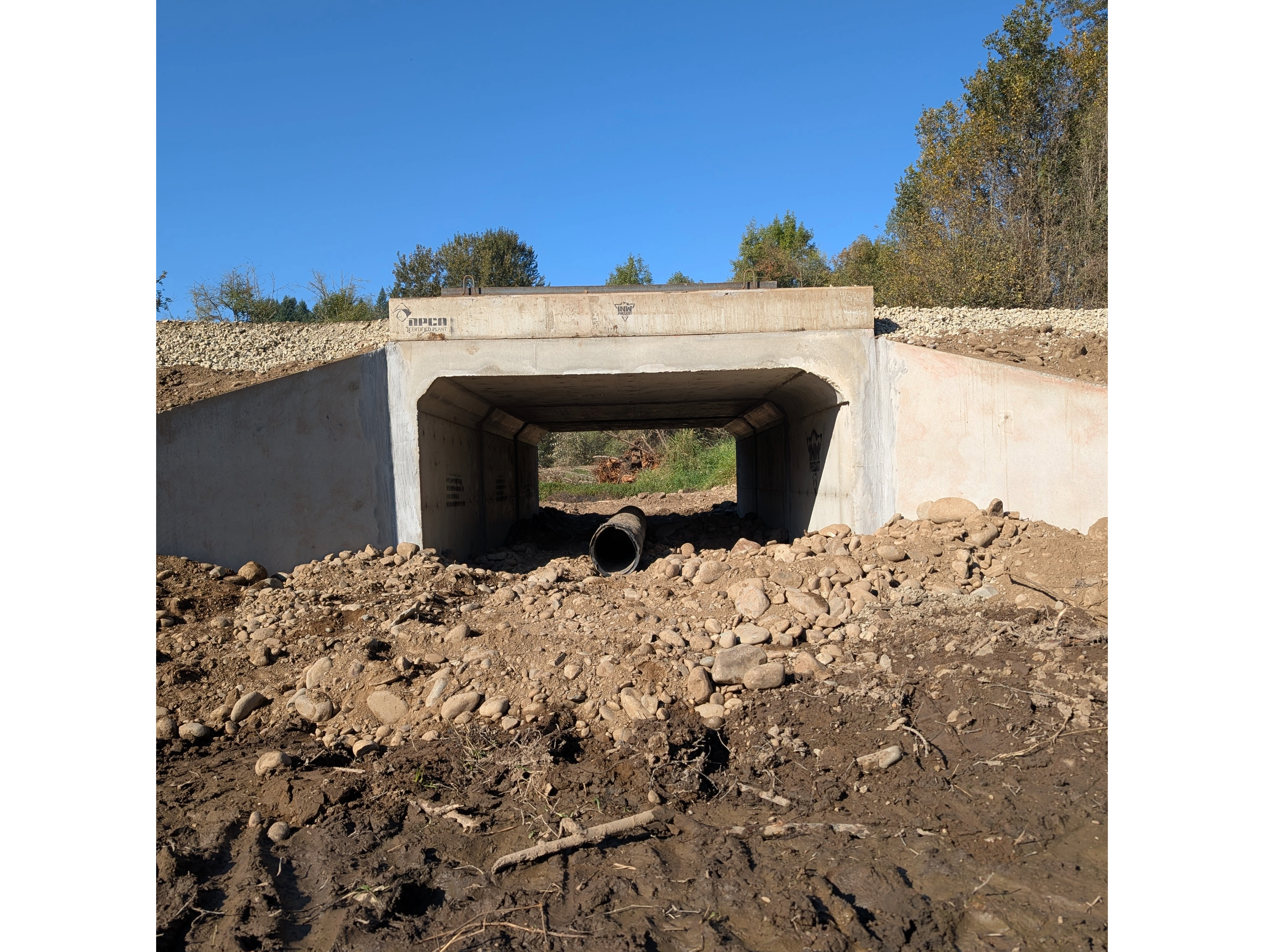
Dyer Creek culvert replacement
Dyer Creek flows into the East Fork Lewis River just below the Ridgefield Pits stretch of the river. A culvert installed under a road blocked fish passage along Dyer Creek. During the first year of the East Fork Lewis River Reconnection Project construction, the 2’ culvert was removed and a with a 6x10’ box culvert was installed. This action, along with the removal of a berm between Dyer Creek and the East Fork Lewis River, restored fish access to more than 27 acres of wetland habitat and over a mile of upstream spawning and rearing habitat along Dyer Creek.
-
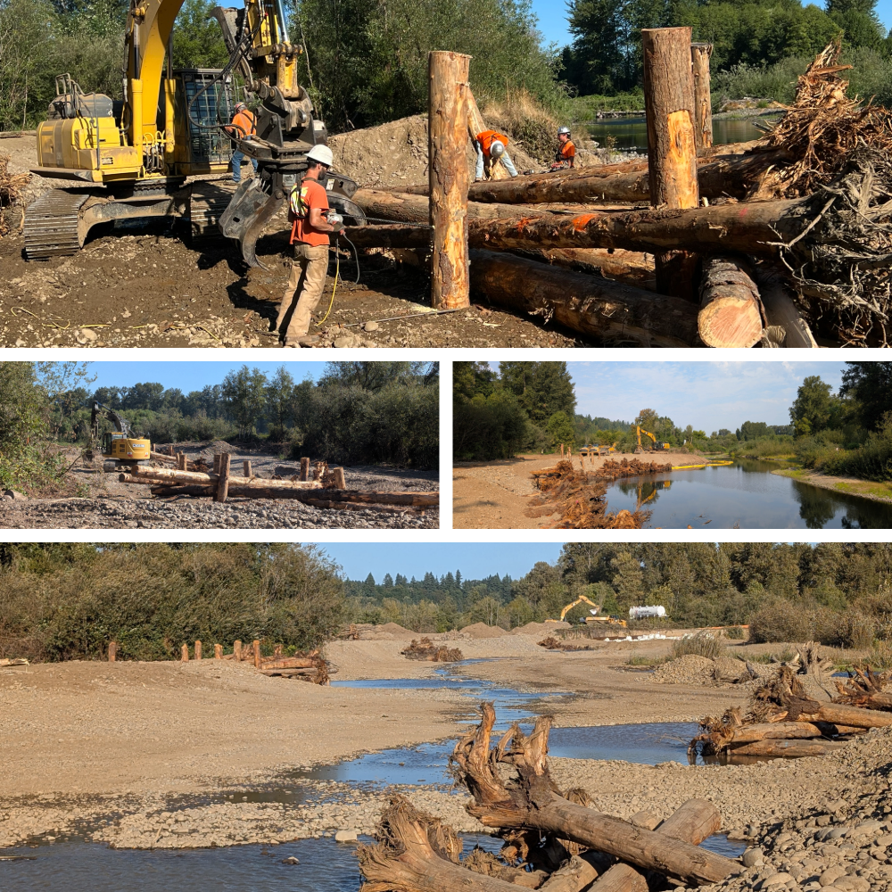
Large woody debris installation
More than 500 large woody debris structures were installed during Year 1 construction. Large woody debris structures create salmon habitat, stabilize riverbanks and floodplain, and help slow and direct the flow of water across the landscape.
Approximately 90% of the timber sourced by Estuary Partnership for the East Fork Lewis River Reconnection Project will either be salvaged from on site or procured from sustainable timber operations. In addition to Clark County, the Estuary Partnership purchased timber from properties managed for habitat restoration (removing Douglas-firs to restore oak savannah habitat) and from privately owned conservation-oriented forestlands.
-
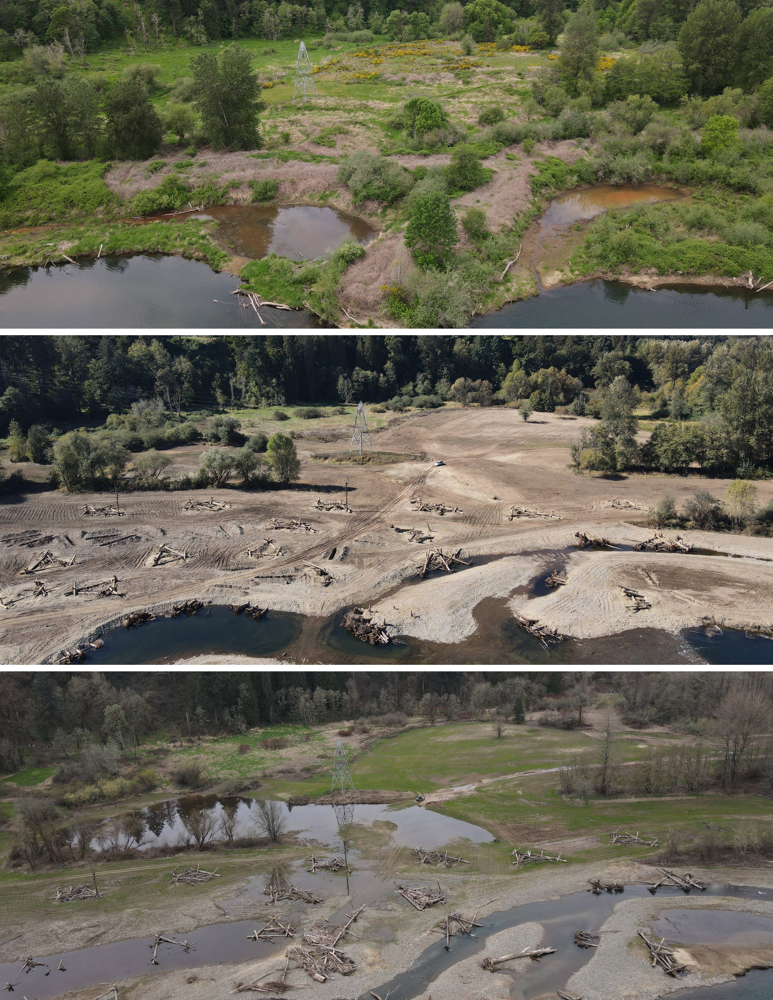
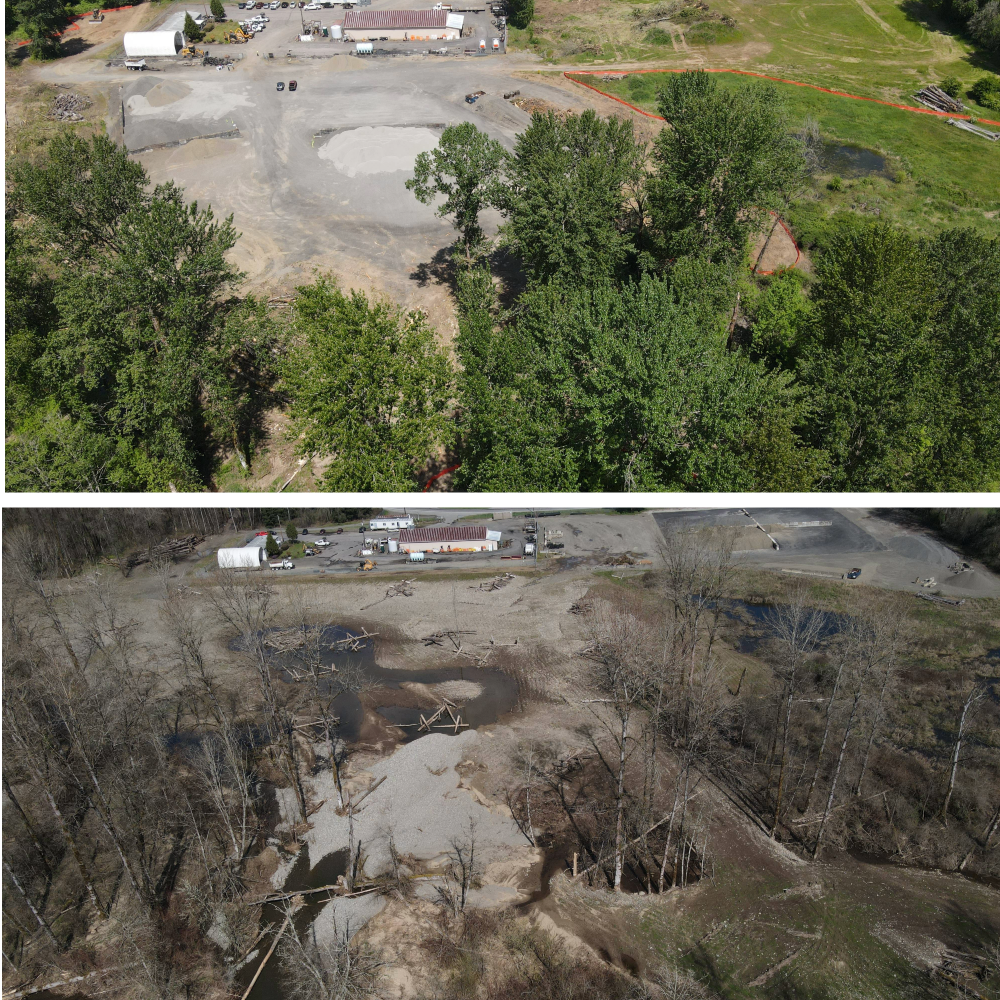
Clark County maintenance yard relocated
A portion of a Clark County maintenance yard was relocated out of the 100-year floodplain to higher ground as part of the East Fork Lewis River Reconnection Project. As a result of the relocation, the flood risk to the maintenance yard decreased and the access for large trucks was improved.
The former maintenance yard was restored to floodplain habitat. The photo series below (clockwise from top left) shows the maintenance yard before construction; the next photo shows the new location closer to the road under construction; the photo on the bottom right shows the fully relocated maintenance yard; and the photo on the bottom left shows the former maintenance yard site restored to floodplain habitat.
-
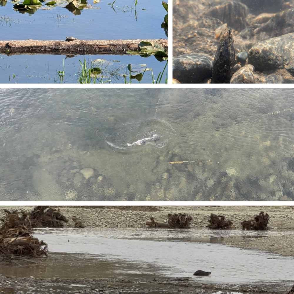
Salmon and wildlife return to the river
Salmon, mussels, painted turtles, and beavers have returned to this stretchof the East Fork Lewis River at the end of the Year 1 construction.
The need for a comprehensive restoration project on the East Fork Lewis River
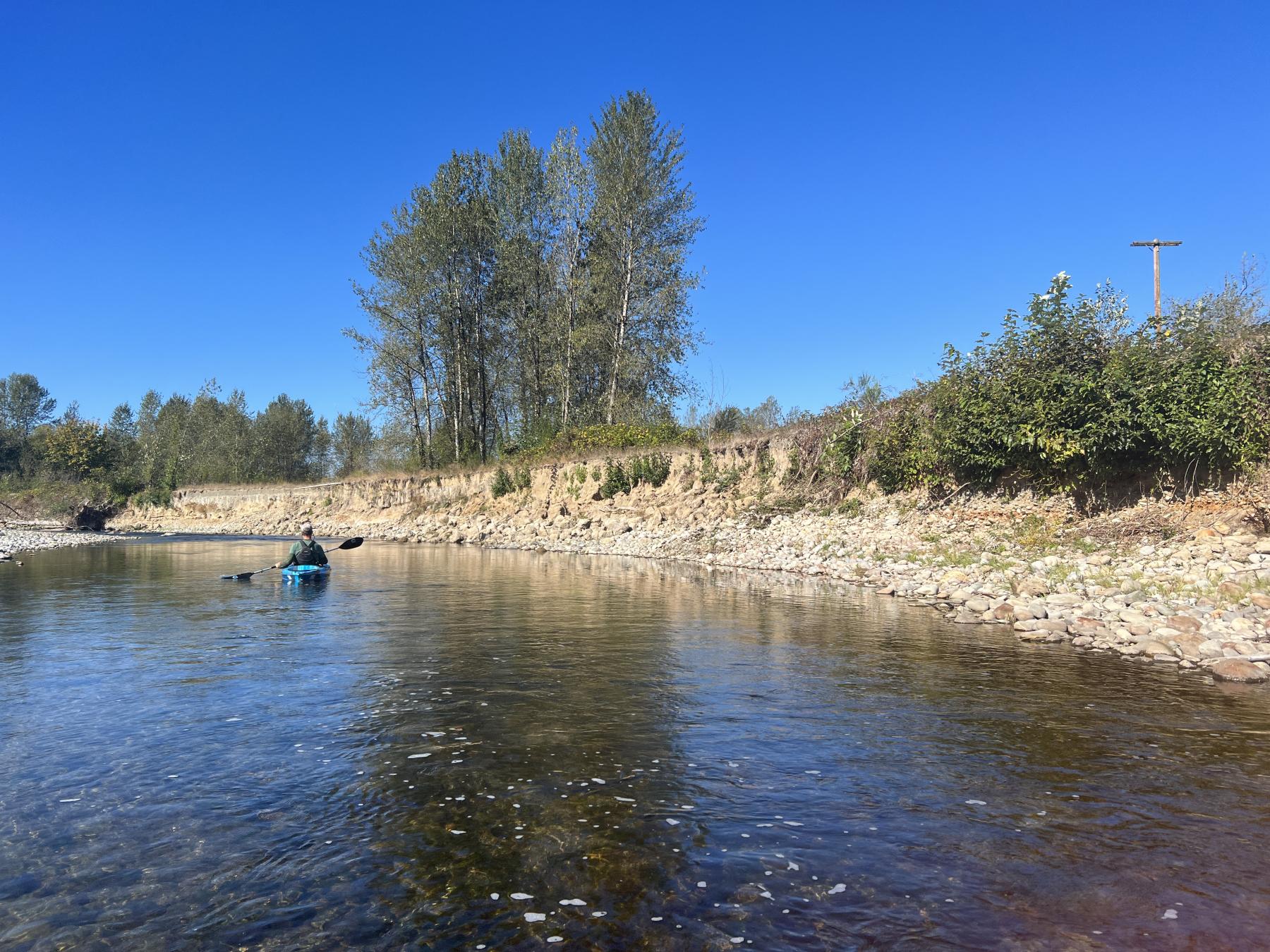
Development and legacy gravel mining along the stretch of river within the East Fork Lewis River Reconnection Project area eliminated a significant amount of the river’s floodplain habitat and drastically altered its path. Historic maps from the 1850s show the East Fork Lewis River as a complex, multi-channel river with vast floodplain habitat, wetlands, alcoves, and side channels. After decades of gravel mining, levee construction, and channel manipulation, this stretch of river now flows in a single channel. A confined, single channel river is much less suited to native species, including juvenile salmon and steelhead.
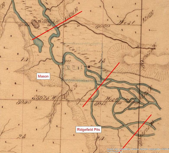
This map is the 1854 Government Land Office survey of the East Fork Lewis River within the project area. The map shows that a large portion of the area was mapped as forested wetland with a braided channel system with multiple side channels and a well-connected floodplain.
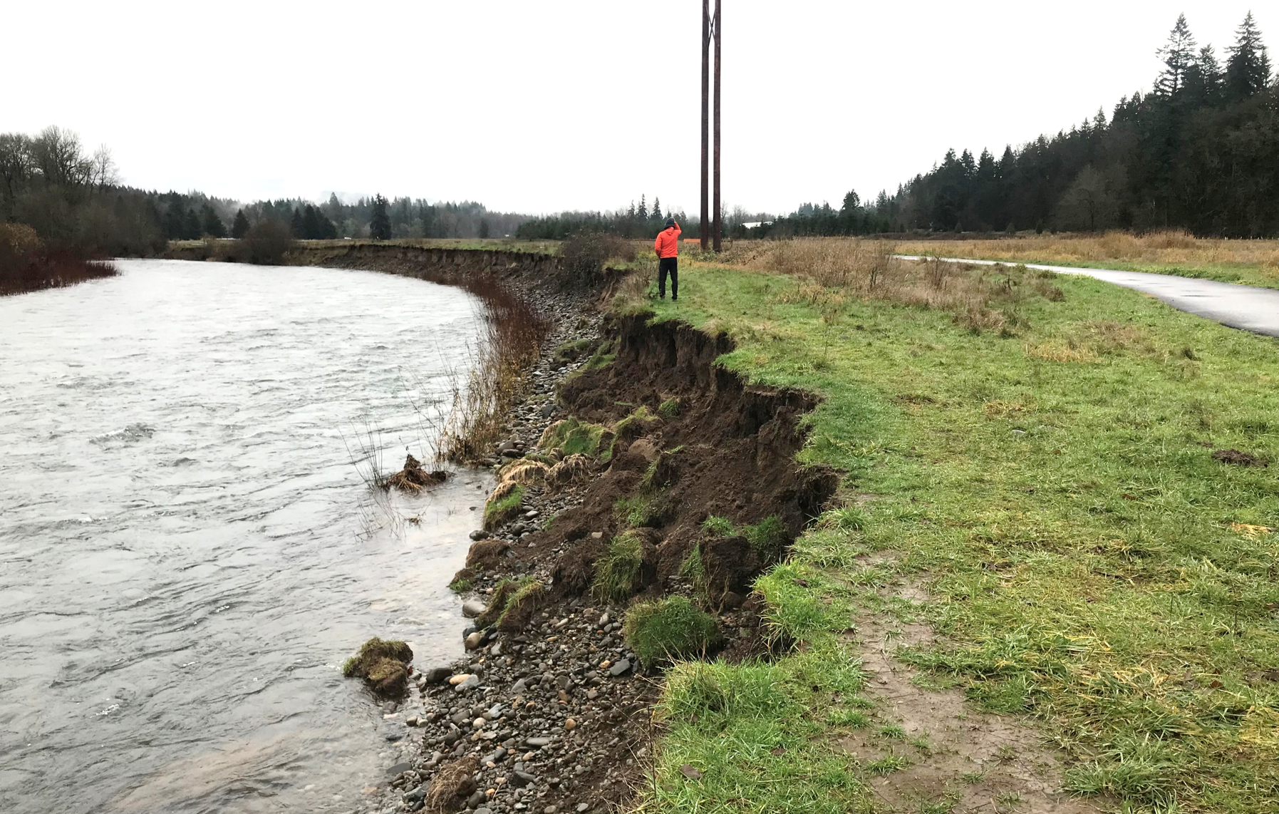
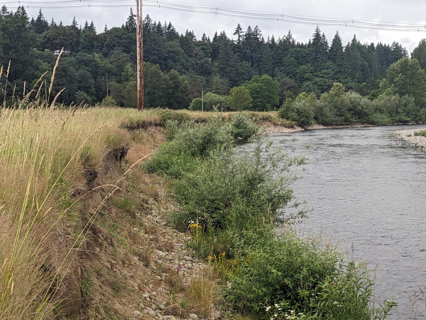
Within the project area, the East Fork Lewis River has been artificially confined into a single channel with levees and other forms of hard infrastructure. The channelization of the East Fork has exacerbated the erosion of the riverbank, threatening homes, critical infrastructure, and businesses.
- Homeowners living along the East Fork Lewis River report losing dozens of feet of property due to erosion.
- Since the new popular walking path along the river at Lower Daybreak Park was built in 2021, the river has eroded 10-15 feet in several locations and threatens the trail and the existing county powerline. Today, the trail is much closer to the river due to erosion.
Persistent erosion puts homes, businesses, and public property at risk.
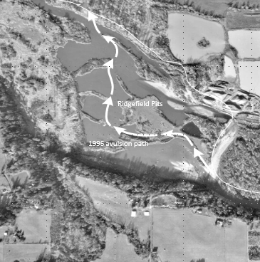
During the historic floods of 1995 and 1996, the channelized East Fork Lewis River broke through a levee that separated the river from the abandoned gravel mine pits, known as the Ridgefield Pits. This caused the river to shift flow to the south and through the pits (see avulsion path in image below), abandoning a long section of channel that had been a spawning area for salmon. Almost three decades later, the river continues to flow through the Ridgefield Pits, causing significant ecological harm to the river, salmon, and other wildlife species.
The ecological damage to the East Fork Lewis River is not isolated to the reach that includes the Ridgefield Pits gravel mines – there have been negative impacts for a large portion of the watershed.
- The river flows through the deep gravel pits which contain an over-abundance of non-native fish that prey on juvenile salmon.
- The river moves extremely slowly through the deep gravel pits, causing the water temperature to rise. High water temperatures create a temperature barrier that migrating salmon and steelhead will not cross, causing significant delays or completely preventing their ability to swim upstream to spawn.
The East Fork Lewis River Reconnection Project Benefits to people, the environment, and the economy
Planning for the East Fork Lewis River Reconnection Project began several decades ago. In 2009, the Lower Columbia Fish Recovery Board (LCFRB) identified the Ridgefield Pits as a high priority project. Beginning in 2016, The Lower Columbia Estuary Partnership worked with Clark County, LCFRB, landowners, state and local governments, environmental nonprofits, community organizations, and the Cowlitz Indian Tribe to develop a plan to reconnect the river to its floodplain and recreate the East Fork Lewis River that existed prior to gravel mining and other floodplain development. Resetting this highly disturbed stretch of river to its natural state not only benefits salmon, steelhead, and lamprey, it makes the homes and businesses adjacent to the river more resilient to flooding and erosion and boosts the local economy.
-
Benefits to salmon and steelhead
 Juvenile salmon that are raised on a floodplain are able to find rich food sources - insects and other aquatic organisms – which help them grow quickly. When water connects the floodplain to the river, trees and shrubs along the floodplain provide great hiding places for juvenile salmon, helping to reduce predation by larger fish. Click here to read a study on juvenile salmon and floodplain restoration conducted by the University of California Davis.
 Locally, a study conducted downstream of the project area on the East Fork Lewis River at the LaCenter Bottoms demonstrated that floodplain wetland habitat on the river were some of the most productive habitat for juvenile coho and Chinook salmon in the region. The study of this highly productive area helped to inform the East Fork Lewis River Reconnection Project’s design.
-
Benefits to flood and erosion risk reduction
Reconnecting the East Fork Lewis River to its historic floodplain will lower the intensity of flood events and harmful erosion by giving the river more room to expand and adjust naturally. Historically, East Fork Lewis River within the project area was a wide, complex, multi-threaded system. Over the past century, the river's historic path has been reduced to a simplified single channel. Without the natural ability to expand onto its historic floodplain, the river moves downstream at an extremely high velocity, eroding riverbanks and increasing flood risk.
The project will also relocate the county maintenance yard located on NE 269th Street out of the 100-year floodplain and move the Daybreak Trail away from a rapidly eroding riverbank, while using natural solutions to reduce erosion.
-
Benefits to groundwater recharge
Restoring the East Fork Lewis River's connection to its historic floodplain allows floodwaters to soak into the ground, recharging groundwater reserves. This cold groundwater is released back into the river during summer months when water levels in the river are low and surface water temperatures are higher, thus helping to alleviate warm water conditions that are harmful to salmon and steelhead.
-
Benefits to recreation
The East Fork Lewis River is well known for its world class fishing, boating, and hiking. The Clark County Legacy Lands program recognizes the incredible the East Fork Lewis River as a vital location for recreation and public access. To preserve public access to the river in perpetuity, Clark County has acquired a significant amount of land adjacent to the East Fork Lewis River. See map of county-owned properties along the East Fork Lewis River. These acquisitions, and the East Fork Lewis River Reconnection Project, are essential steps towards a future East Fork Lewis River Greenway Trail. In the short term, the East Fork Lewis River Reconnection Project is moving the popular walking trail along the river at Daybreak Park away from the river (erosion is threatening the safety of the trail).
-
Benefits to the economy
The East Fork Lewis River Reconnection Project is a $23.5 million restoration project. Funding for this project was awarded by separate state and federal agencies through highly competitive processes. Without such a robust, compelling, and community-supported project, these grants would have gone elsewhere in the state or nation. The Estuary Partnership selected Battle Ground-based Tapani Inc. to construct the East Fork Lewis River Reconnection Project. The construction contract with Tapani Inc. represents 46% of the project's total budget.
In a press release announcing the award, Brandon Farmer, a Senior Project Manager at Tapani Inc., had this to say:
“As a family-owned business rooted in Battle Ground, Tapani is excited to contribute to a project that strengthens both the community and environment in Clark County. The East Fork Lewis River Reconnection Project will provide jobs for upwards of 35 people in our highly skilled workforce. Our crews know this river well—it’s where our families fish, swim, and explore. Partnering with the Estuary Partnership is a meaningful opportunity to restore and enhance it for future generations,” stated Brandon Farmer Senior Project Manager at Tapani.
Media spotlight on the East Fork Lewis River Reconnection Project
Local newspapers have reported on the progression of the East Fork Lewis River Reconnection Project. Here are several articles that provide more information about the project:
-
Actual Miles Restored
3.00
-
Start Year
2025
-
Type
Habitat