Summer temperatures in the mainstem Columbia River have been rising for decades. Migrating fish face temperatures in the mainstem Columbia that regularly exceed levels that are harmful, potentially even lethal, to them. When temperatures rise, migrating salmon frequently use pockets of cooler water at tributary confluences to rest and feed.
Our Cold Water Refuge study evaluated the potential for creating and enhancing thermal refuge zones for migratory fish in the lower Columbia River.
In summer 2015 and 2016, we assessed and mapped cold water inputs to the lower Columbia, including tributaries, springs, and groundwater seeps. We found a 57-mile gap of suitable cold water refuge between the Lewis River and Eagle Creek. While there are tributaries in this gap that supply cold water, due to their smaller flows and topography, their plumes are immediately diluted as they enter the mainstem.
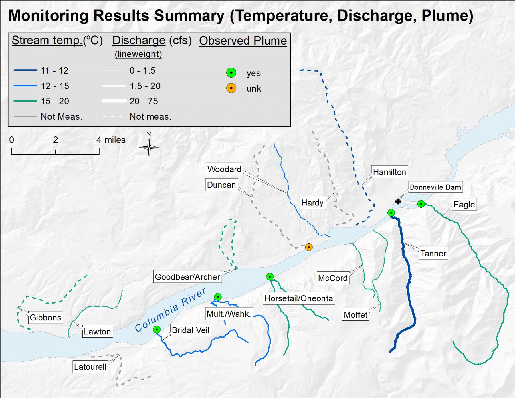
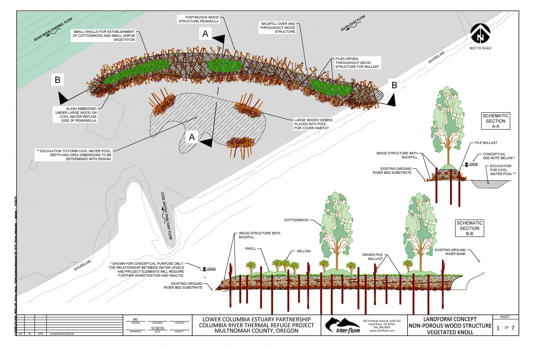
In the next phase of the project, we are exploring techniques to create protected pockets of cold water at tributary confluences. Through hydrodynamic and temperature modeling we found that strategic placement of structures can significantly increase the size of cold-water zones at the confluences of Bridal Veil, Horsetail, and Multnomah Creeks, making them available to adult migrating salmon. We are currently designing a pilot project to use a diversion structure to enhances the cold water zone at Horsetail Creek.
Funding for the study came from US EPA, and funding for the pilot project comes from Oregon Watershed Enhancement Board and East Multnomah Soil and Water Conservation District.