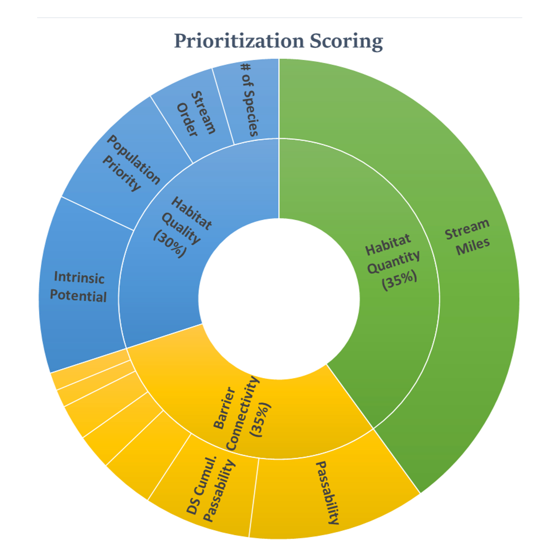
 The Lower Columbia Barrier Inventory & Decision-support Tool was developed in 2024 by the Lower Columbia Estuary Partnership for Washington's Lower Columbia Fish Recovery Board. It includes a geodatabase inventory of fish passage features in southwest Washington's lower Columbia Region, and an accompanying decision-support model. The model is intended to help prioritize the selection of fish passage barriers for passage improvement projects. It generates scores for anadromous fish passage barriers in the inventory, which reflect the relative value of implementing fish passage improvement projects at any given feature, with the highest scores indicating the highest benefit. Scores range from 0-100, and are calculated based on a variety of metrics, including available upstream habitat quantity and quality, passage severity, and connectivity of the feature within the anadromous stream network.
The map includes the Barrier Inventory with features symbolized by fish passage severity, as well as 6 separate scoring layers for the individual species of salmon present in the region, and an additional layer showing the average of these 6 scores. It also includes supporting data layers that also inform the decision-support model. These include a species specific Habitat Quality (Intrinsic Potential) layer, as well as Species Distribution layers which show the extents of each species and are used to estimate the amounts of available upstream habitat.
Users can interact with the map (below) by accessing the tool buttons on the left, which include toggling layers on and off, adding a legend, changing basemaps, etc.
A Quick Guide to navigating the map and interpreting the data is available here.