Reach: 1
Launch and Land: Dalton Point to Rooster Rock
Distance: Anywhere from 5 miles to….whatever you like
Chart: NOAA Chart 18531, Columbia River, Vancouver to Bonneville
Skill level: Beginner to Advanced, depending on wind
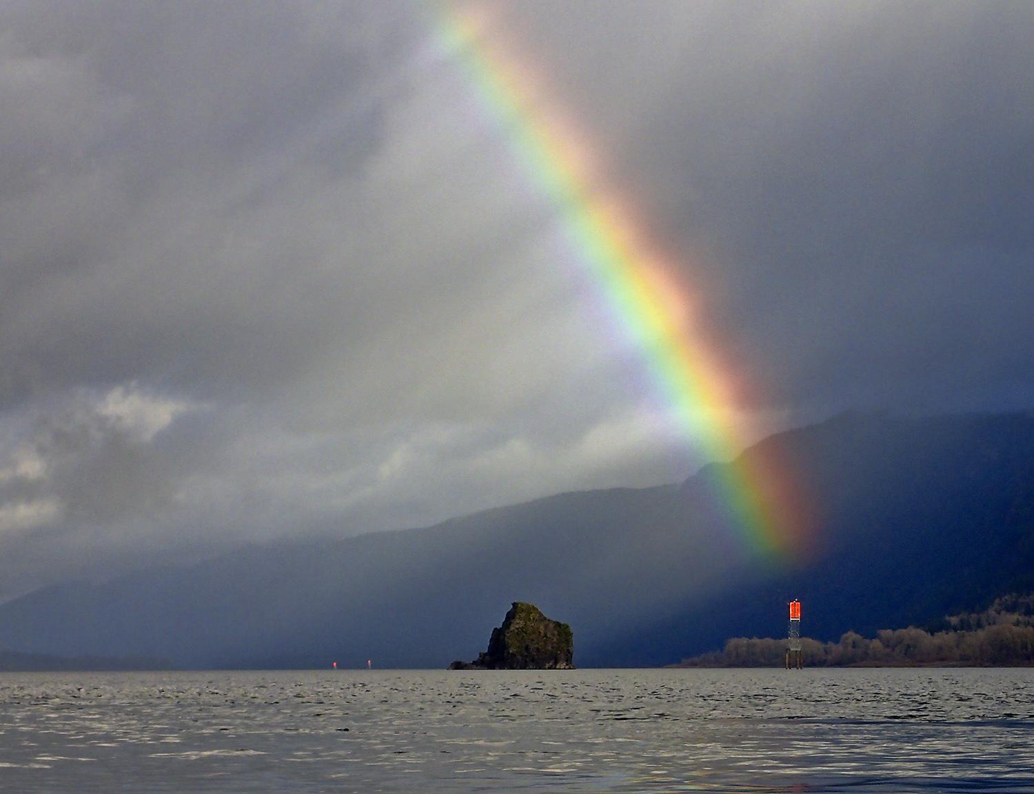
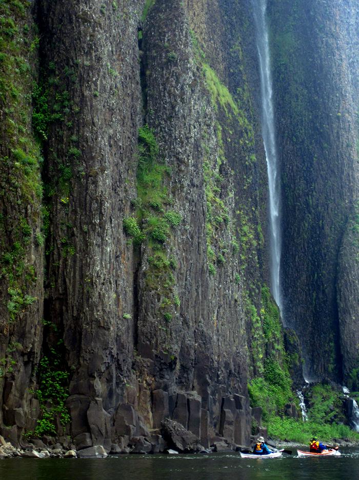
Gorge travelers have marveled at the Cape Horn cliffs from I-84 since the freeway was built in 1956. The cliffs drop straight into the water, and passengers who can afford to take their eyes off the road will spot at least two waterfalls. Phoca Rock and Cape Horn are stunning, easily visible from the freeway, and close to Portland. So it’s amazing more people don’t visit the place.
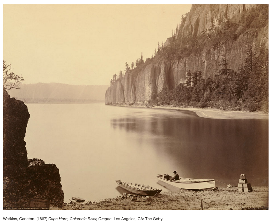
Historically they did. Lewis and Clark noted the narrow spot, where the basalt comes to river level. In fact they had a fairly miserable experience on the Oregon side of the river just downstream of the cliffs on their return journey east in 1806. The wind and waves were so large they had to unload their canoes and haul them up the bank. Half a century later, Carleton Watkins, whose images were the first view most Americans ever saw of the west in 1860s, made a famous mammoth-plate photograph of Cape Horn from river level in 1867. Yet in my twenty years of paddling the Columbia, I’ve run into precisely zero other paddlers at Cape Horn.
Today there will be three of us, and a west wind is ready to greet us. On most summer days the heat in the desert of eastern Oregon draws air from the cooler west side, creating the Gorge’s famous winds. Today “cooler west side” is relative, since we’re in the midst of a 90-degree heat wave. The breeze is refreshing, but it offers challenges, too.
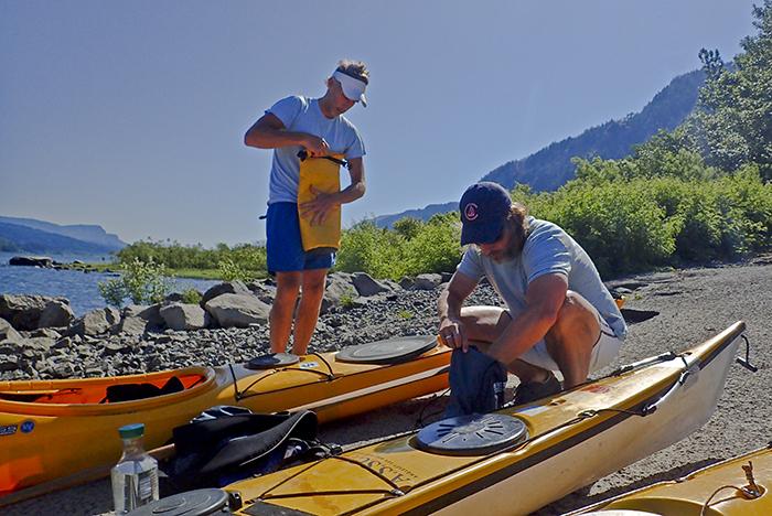
Sam is a novice kayaker. Our launch at the sleepy, lightly trafficked boat ramp at Dalton Point, just west of Multnomah Falls, and the 6-inch wind waves wash onto the ramp. Chris Hathaway, Community Programs Director of the Lower Columbia Estuary Partnership, helps Sam get fitted into his kayak, and we spend a few minutes going over basic boat control near shore. Then the crossing begins.
The main reason for so few paddlers Cape Horn may be that the first crossing looks intimidating: there’s no way to avoid shooting straight across the Columbia to Phoca Rock, in the middle of the two-mile wide river. You’re fully exposed to the wind. But it’s usually easier than it seems, especially on summer days. As Sam soon realizes, west winds don’t pack too much punch at Cape Horn, the western edge of the Gorge. It’s the winter east winds that cause problems here.
Phoca Rock, a basalt plug in the middle of the river, was misnamed by William Clark. Phoca is the latin name for seal. Clark wrote that “The Seal or Phoca are found here in great numbers, and as far up the Columbia as the great Falls, above which there are none." He was probably wrong. They were almost certainly sea lions, which hang out on Phoca Rock in winter and spring, barking at kayakers and feeding on salmon. Since sea lions are a west coast species, Clark had never seen one, and mistook them for seals. Today, the rock is empty, so we paddle around it before crossing the shipping channel to Cape Horn.
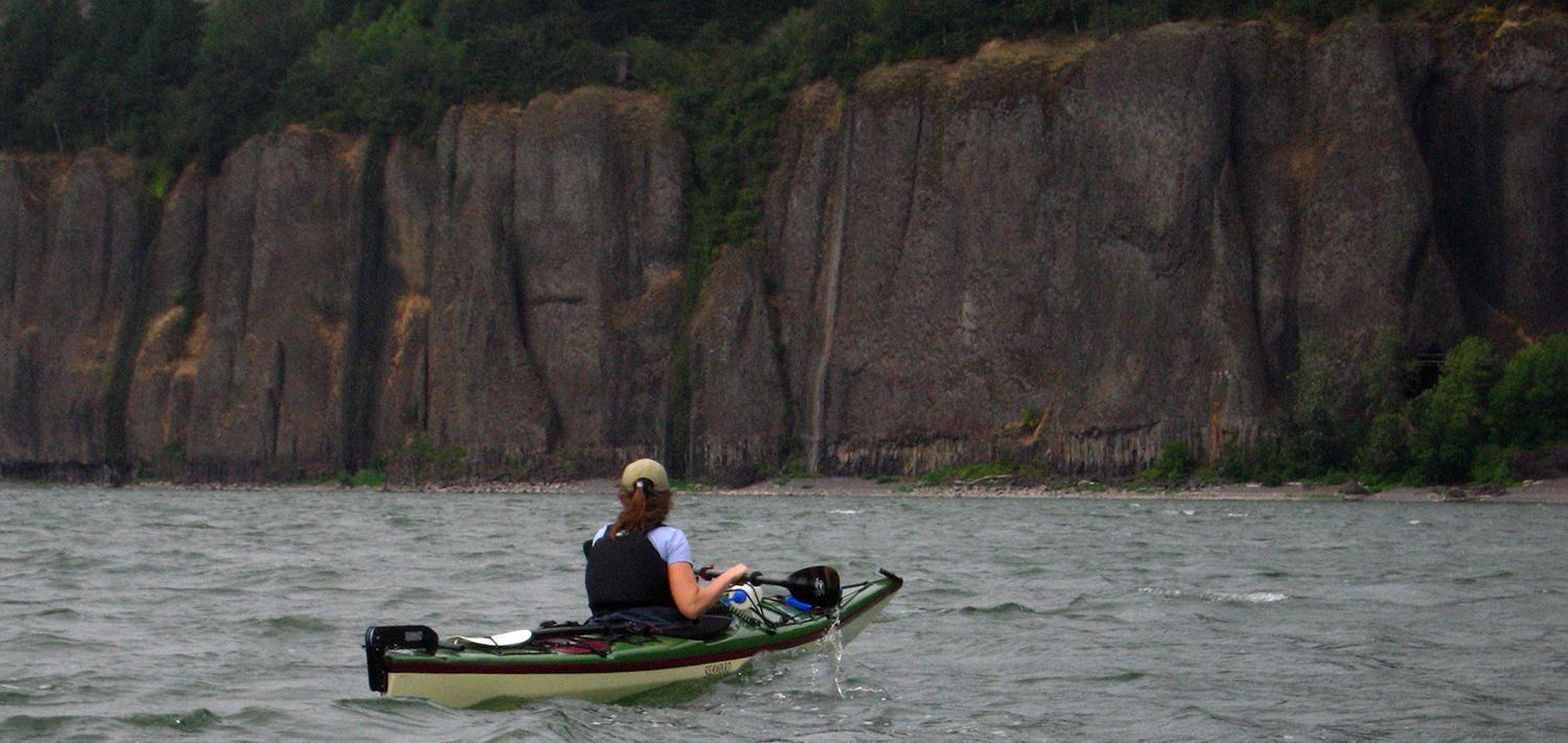
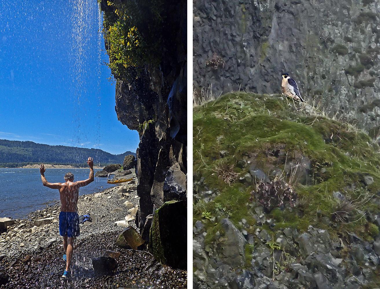
Cape Horn is made of several bands of massive basalt cliffs, the lowest one coming directly into the water, with some small gravel beaches perfect for lunch. This year has been unusually dry, so the waterfalls are a gentle shower, and it’s hot enough to enjoy standing under them. In winter and spring, they’re raging torrents: Cape Horn’s scenery is most dramatic when the waterfalls are gushing and the river is wrapped in clouds. But there’s nothing wrong with it on a sunny day either.
Also absent today is the local pair of peregrine falcons, a common sight at Cape Horn. They’re often out hunting from their nest on the cliffs, and the trail at the top is closed during nesting season. No falcons today, but osprey are out in force.
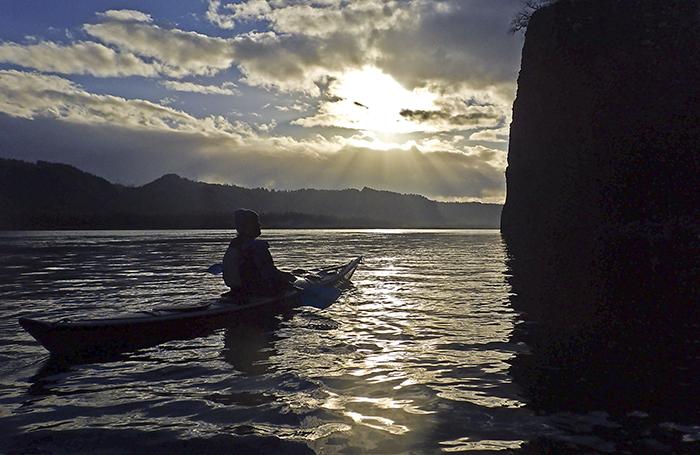
After our lunch break, we follow the Washington shoreline until the cliffs end. Across from the west end of Cape Horn is Rooster Rock State Park. Part of its sandy riverfront beaches are clothing-optional, and I suspect many a paddler has been surprised here when they’ve pulled in for lunch. Today’s a weekday, so the beach is empty, and we work our way down the Oregon shore until we round the hook into the deep, protected bay that houses the Rooster Rock boat ramp. Another day on a beautiful, accessible, half-day paddle close to Portland, where I encounter no other paddlers. The mystery continues.
Why you should go: Unparalleled Columbia Gorge scenery close to Portland, an easy half-day paddle, or longer if you want.
If you go: Watch the wind forecast. West winds create big waves on the eastern end of the Gorge, and Cape Horn only sees small effects. But when the east wind blows—usually bitter cold in winter—beware. The wind and waves here can be hellacious. During the rainy season, the waterfalls are spectacular. Look both ways before crossing the shipping channel.
Distance: 6-7 miles to Rooster Rock Boat Ramp, easily combined with longer trips
Launch: Dalton Point, one mile west of Multnomah Falls (exit I-84 westbound only)
Land: Rooster Rock State Park, or a longer paddle to Chinook Landing
Nearby: The Sandy River Delta, Multnomah Falls, and the heart of the western Columbia Gorge. The Cape Horn Trail from the top of the cliffs leaves from Highway 14, though it is closed February 1 until July 15 to protect nesting falcons.