The sky is the limit! We recently obtained a new Unmanned Aerial Vehicle (UAV). This cutting-edge tool will dramatically improve our ability to monitor and research habitat restoration and reference sites on federal lands.
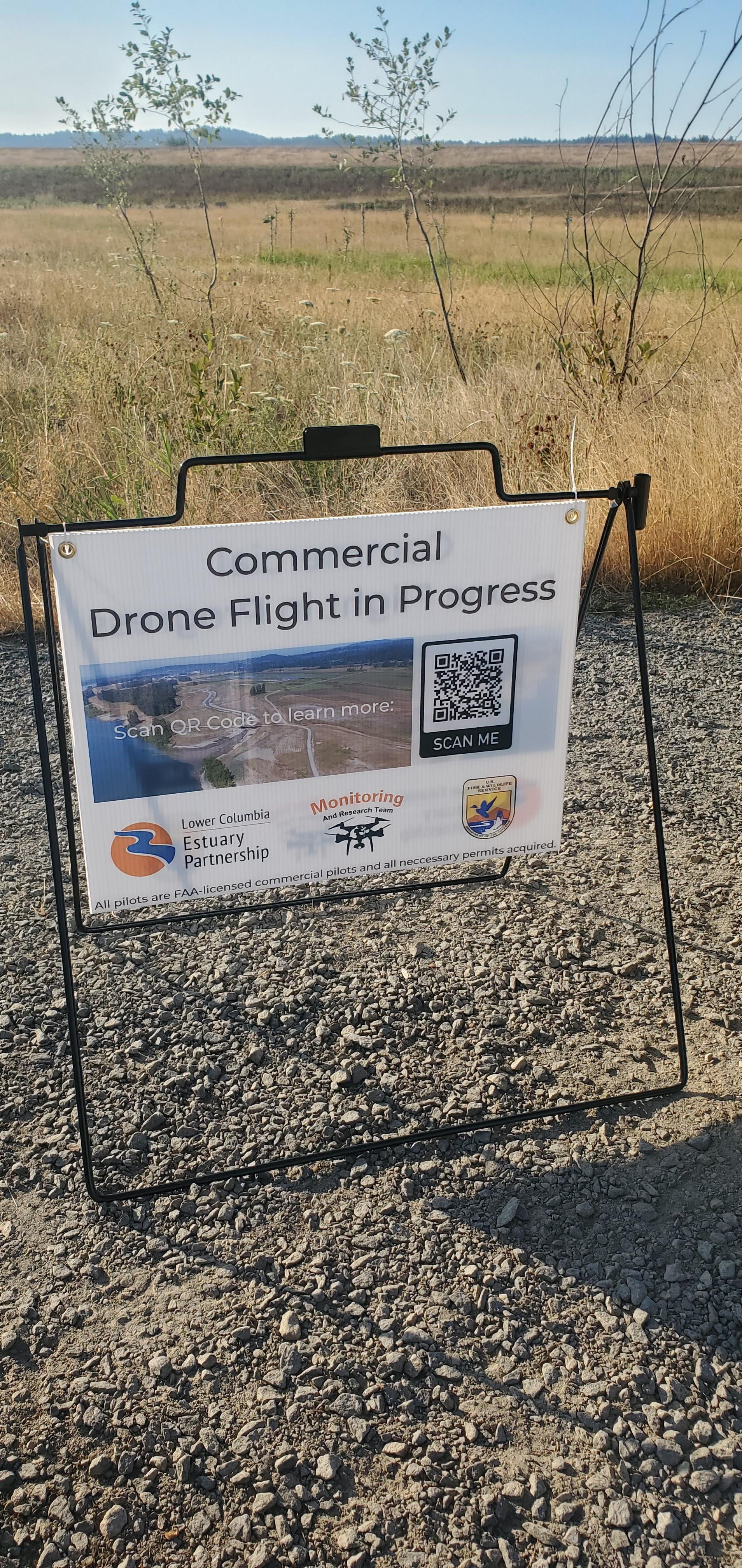
Since 2017, our Monitoring and Research Team has been using UAV technology for several aspects of habitat monitoring, including modeling site topography and identifying dominant plant communities. But in 2020, new federal regulations on UAVs effectively grounded our equipment at federally owned sites like the Steigerwald Lake National Wildlife Refuge.
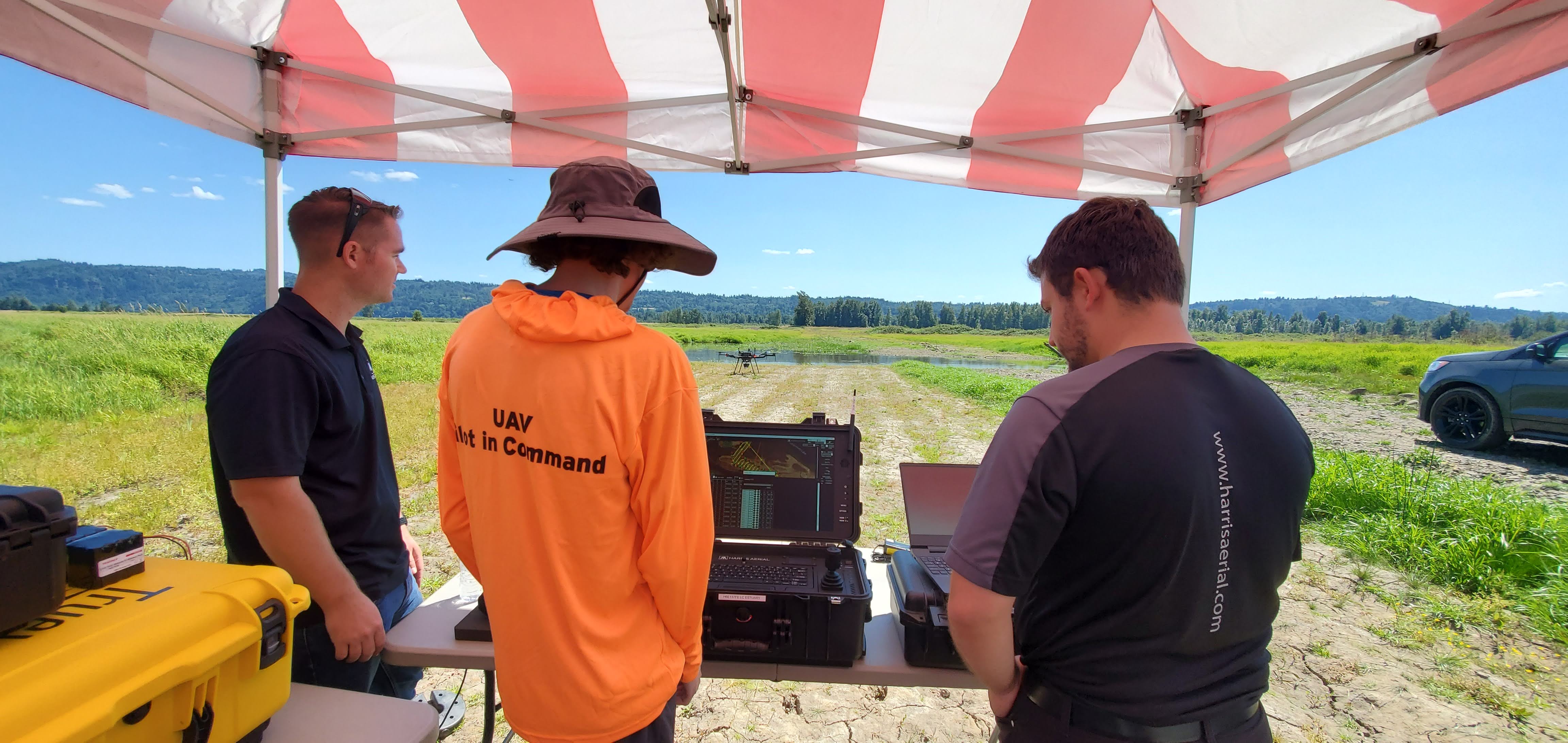
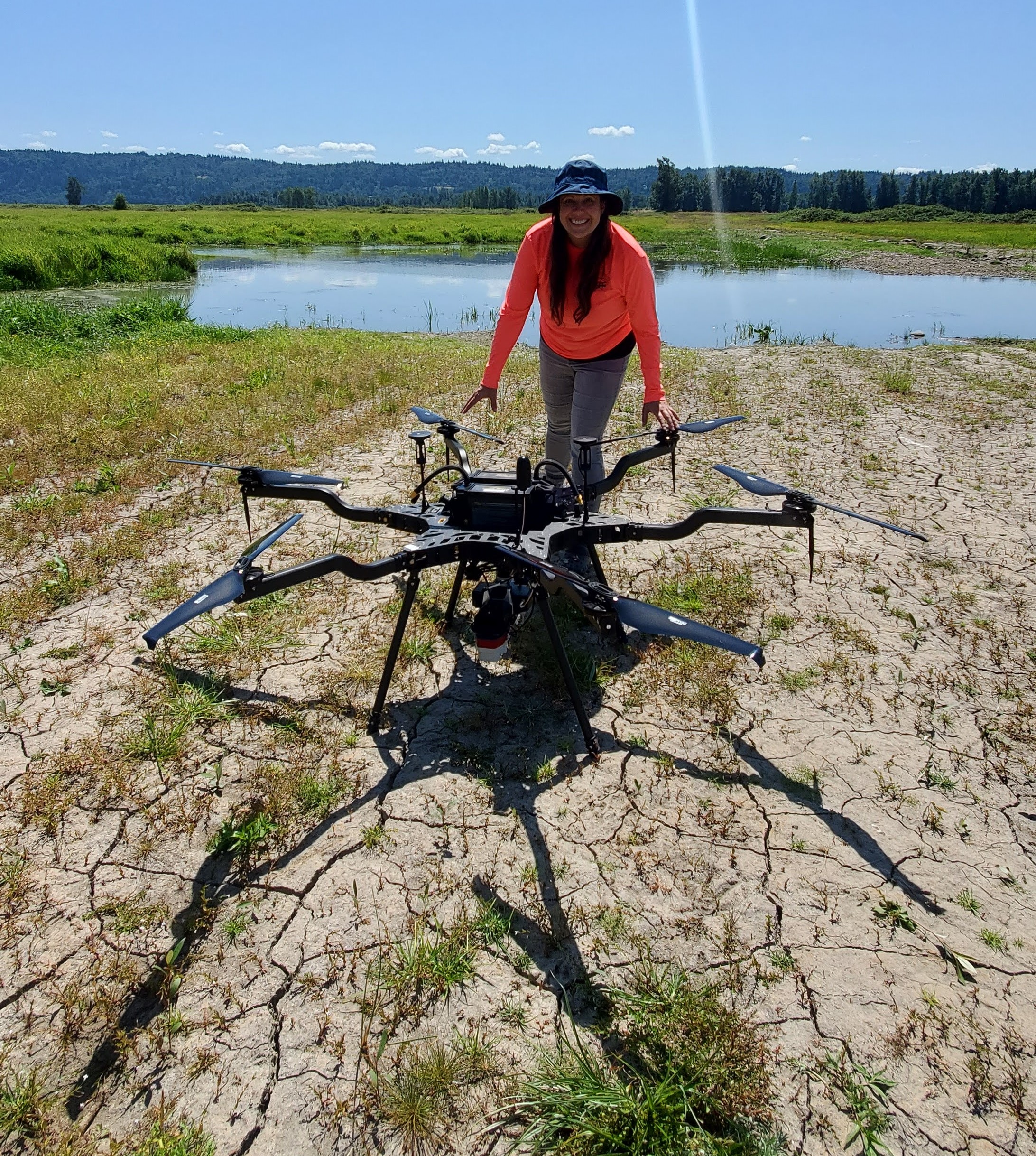
This year, the Monitoring and Research team overcame the regulatory roadblock with the procurement of a Department of Defense-approved UAV. The Harris Aerial Carrier H6 HE+ Hexacopter UAV is equipped with sensors capable of visible light (RGB), multispectral, thermal infrared, and Light Detection and Ranging (LiDAR) detection. With this UAV, the monitoring team will be able to capture high-quality data to aid in cutting-edge wetland research. Our new UAV is a transformative upgrade that promises to enhance restoration efforts and the design, construction, and monitoring of restoration projects throughout the lower Columbia River. Plus, it’s really fun to fly!
Thank you to the Bonneville Power Administration’s Columbia Estuary Ecosystem Restoration Program for supporting this investment in monitoring and research in the lower Columbia River region.