Year 1 of the East Fork Lewis River Reconnection Project is complete. On September 26, crews removed the coffer dam that has been diverting the East Fork Lewis River around the Ridgefield Pits portion of the project site since June.
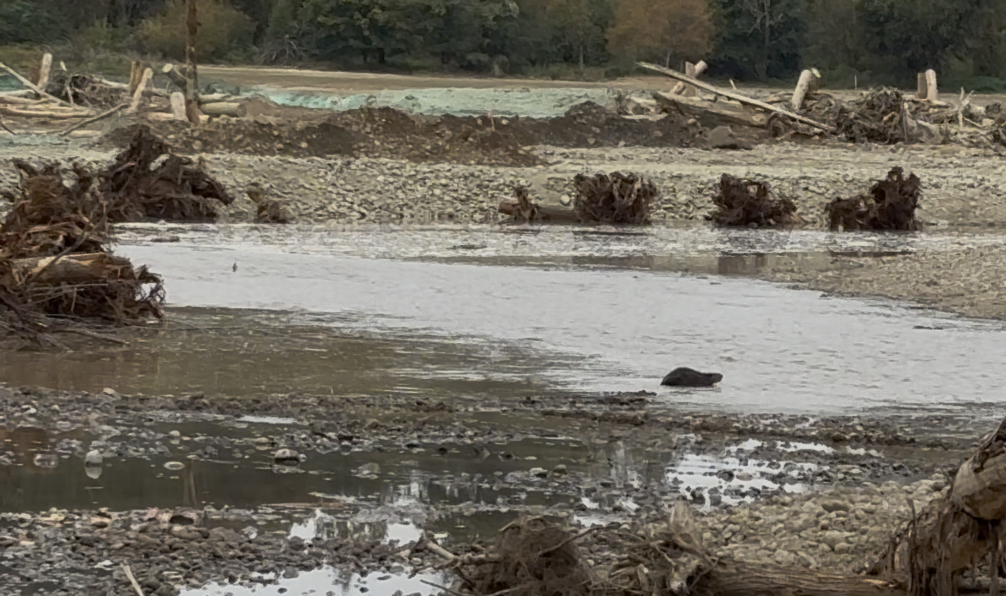
Salmon are already spawning in their newly restored habitat, and beavers began checking out their new river home immediately after the coffer dam was removed!
Next year, the remaining three gravel pits will be reclaimed and reconnected to the river. Trail improvements and erosion protection at Lower Daybreak Park will also occur next year.
See how the site has changed:
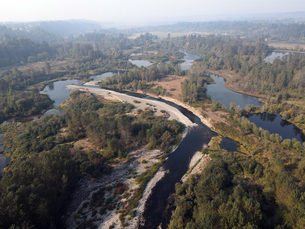
Before the construction of the East Fork Lewis River Reconnection Project, at right.
Beginning of Year 1 construction – a temporary bridge and roads are installed to facilitate restoration actions. (Photo credit Kurt Cichosz.)
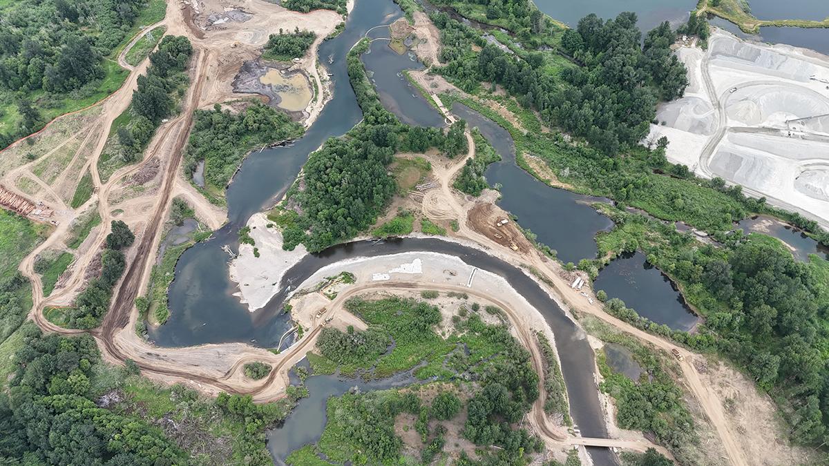
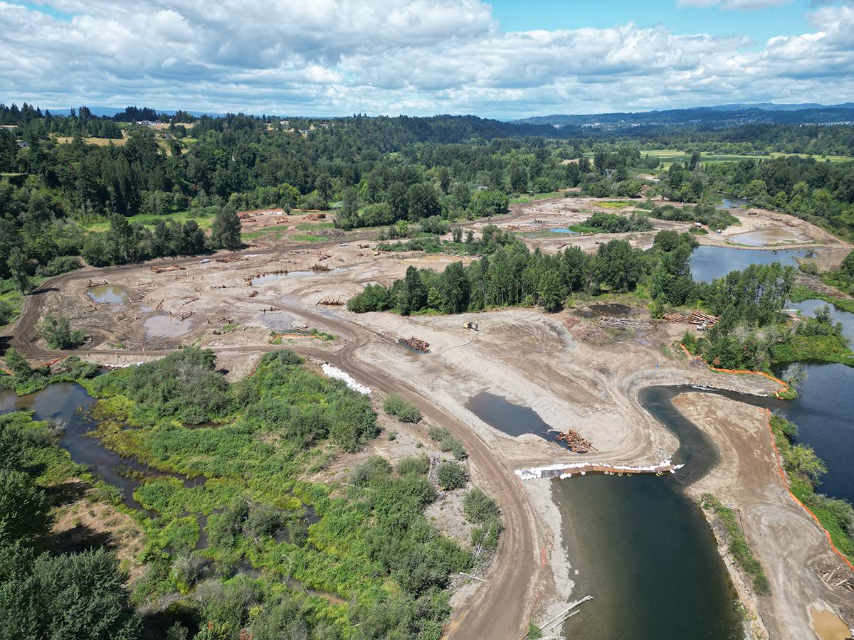
Early summer Year 1 construction – a coffer dam diverts the East Fork Lewis River out of the Ridgefield Pits so dewatering, aquatic rescue, and reclamation can occur. (Photo credit Kurt Cichosz.)
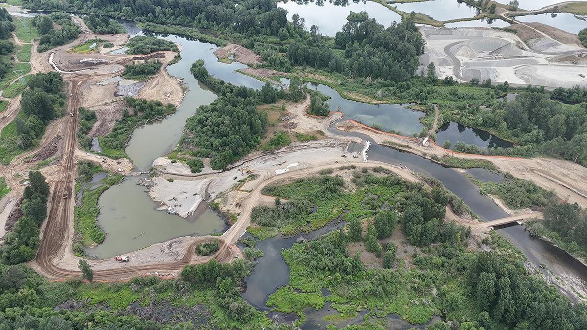
Late summer Year 1 construction – four of the former gravel mining pits have been reclaimed. (Photo credit Kurt Cichosz.)
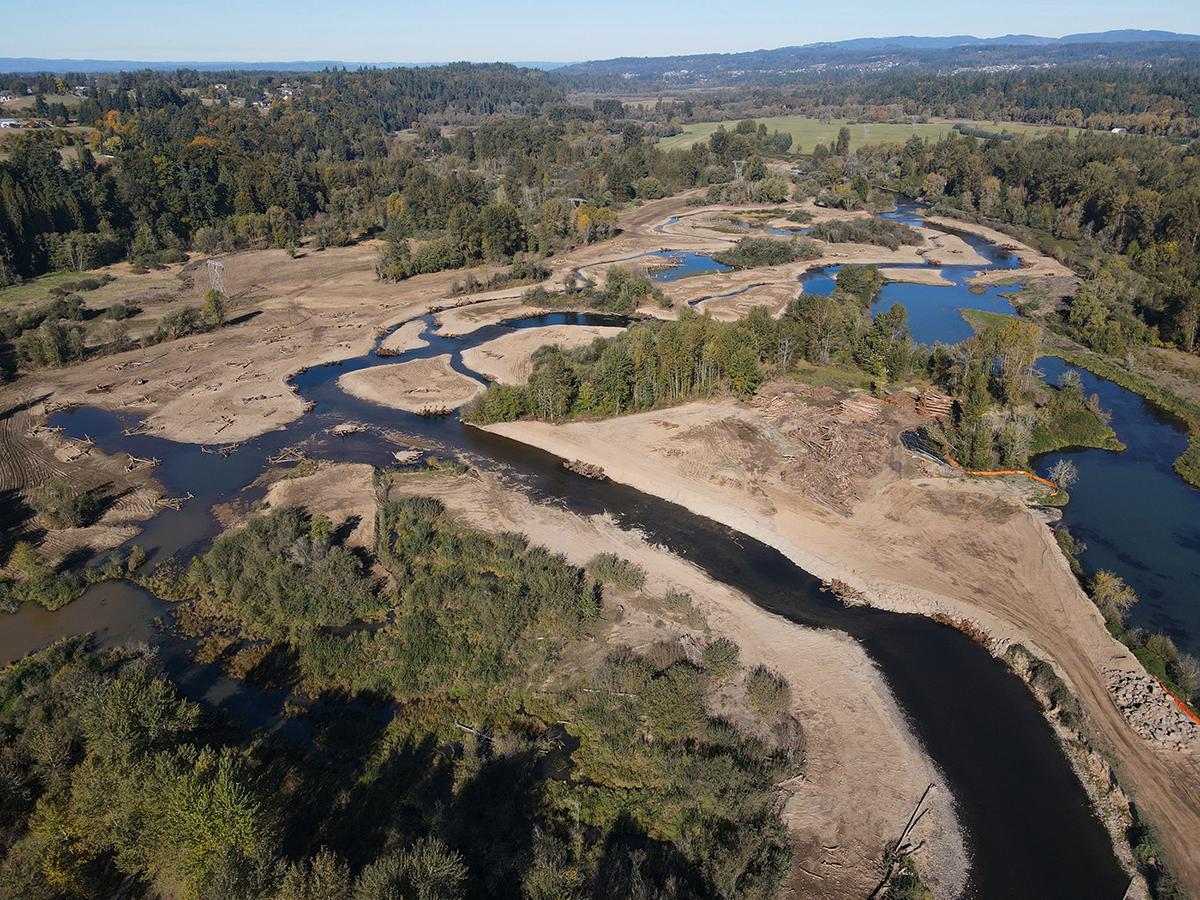
After Year 1 construction ended, but before the fall rains began.
Here is a brief recap of Year 1 accomplishments:
- Four abandoned gravel pits were reclaimed and reconnected to the East Fork Lewis River floodplain;
- 10,000 feet of side channels were built – recreating the historically braided river conditions in this stretch of the East Fork Lewis River;
- 160 acres of floodplain were reconnected to help absorb floodwater, recharge groundwater aquifers, and provide habitat for salmonids and other wildlife;
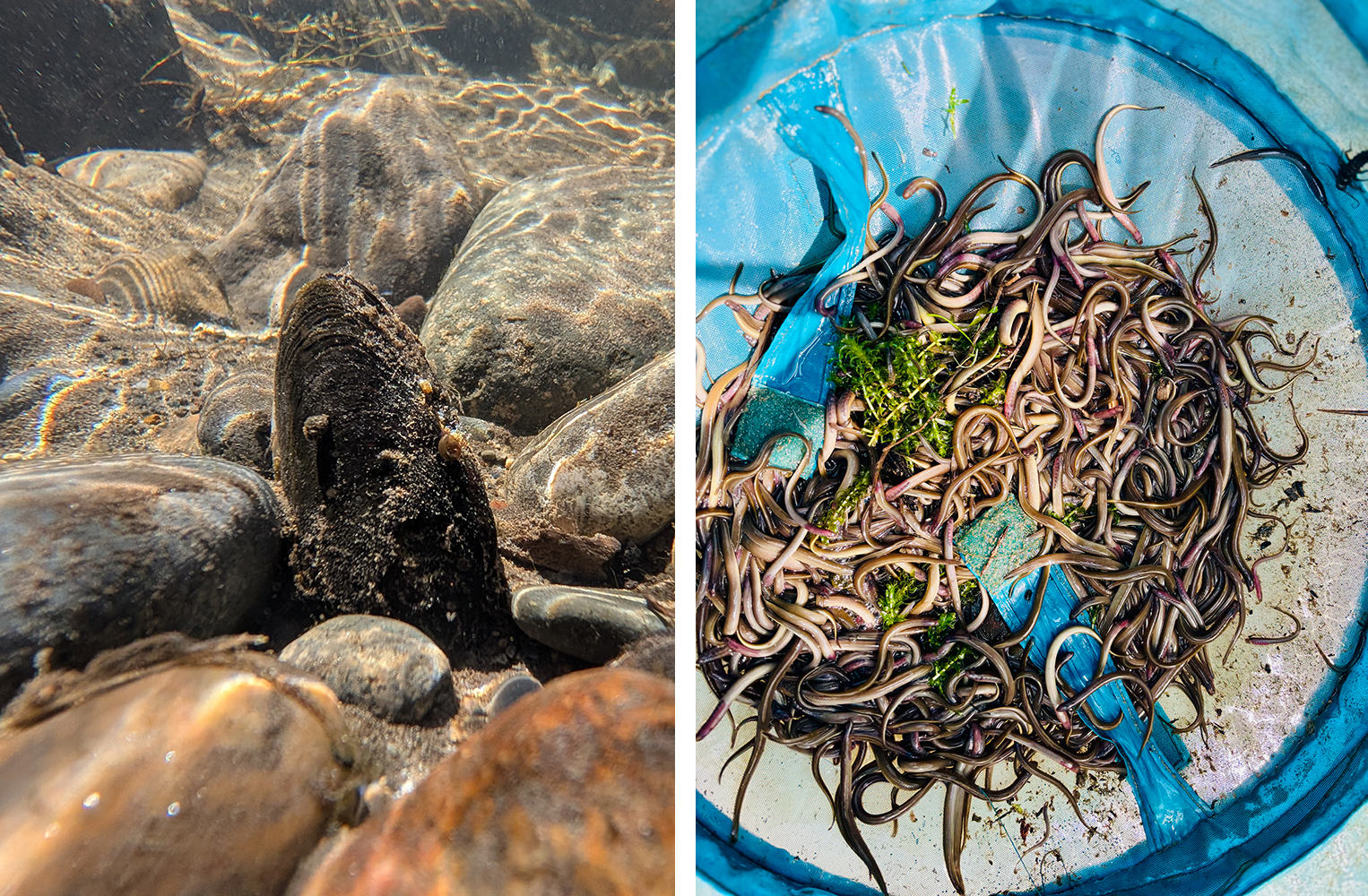
- Over 2,000 volunteer hours were logged during the fish, lamprey, mussel, and painted turtle relocation efforts that preceded in-water construction in each pit;
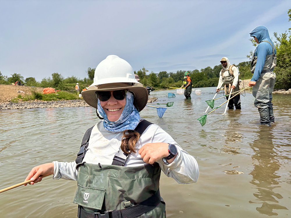
- Crews with Ecological Land Services, ERSM, and Tapani provided additional support. In total, more than 81,000 juvenile lamprey, 45,000 freshwater mussels, 46,000 fish (including juvenile salmon, native largescale suckers, and sculpin), and more than 50 native painted turtles were relocated from within the project boundary to nearby suitable habitats;
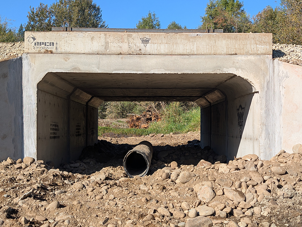
- A 2’ culvert was replaced along Dyer Creek with a 6x10’ box culvert. This action, along with the removal of a berm between Dyer Creek and the East Fork Lewis River, restored fish access to more than 27 acres of wetland habitat and over a mile of upstream spawning and rearing habitat along Dyer Creek;
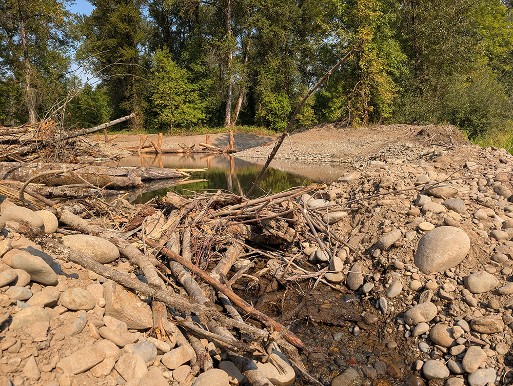
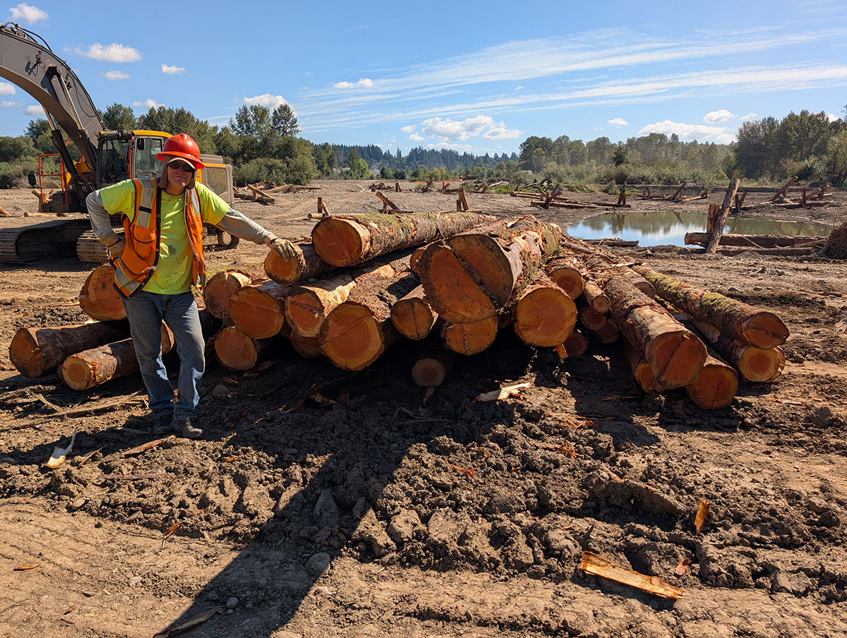
- 13 different kinds of large woody debris structures were developed to create more than 500 habitat structures throughout the site; and;
- A Clark County Public Works staging yard was moved out of the 100-year floodplain into an area with better road access and increased flood protection. The footprint of that facility was restored to a healthy, active floodplain.
During the fall and winter months, revegetation crews with R. Franco Restoration and Biohabitats will be onsite planting over 150,000 native trees and shrubs. Volunteer opportunities will also be available – stay tuned!
We extend our sincere gratitude to everyone who contributed to the successes during the Year 1 construction of the East Fork Lewis River Reconnection Project: the hardworking crews at Tapani Inc., Aquatic Contracting, ELS, Inter-Fluve, Trout Mountain Forestry, Mt. Hood Environmental, HFI Constants, ERSM, the dedicated volunteers who helped with aquatic relocation, and to our visionary project partners at Clark County.