About this location
-
Water trailColumbia River
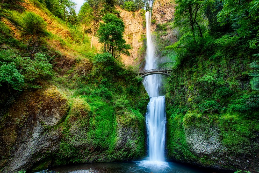
Multnomah Falls is the nation’s second highest year-round waterfall. Originating at an underground spring on Larch Mountain, Multnomah Creek cascades several miles through the forest before plunging 620 feet over the basalt cliff to dazzle over two million visitors per year.
Multnomah Falls actually consists of two separate drops. The top falls measures 542 feet, and the bottom falls, over less easily eroded rock, 78 feet. The falls are slowly retreating backward, upstream into the cliffs. Water works its way into cracks in the rock where it freezes and expands, wedging the rock apart and sending pieces—some as large as school buses—crashing to the bottom. This process results in a natural amphitheater that stages the spectacular falls.
Between the two falls is the Benson Bridge, built by Italian stonemasons in 1914 when the land was owned by Simon Benson. The falls were one of the primary attractions when the Historic Columbia River Highway was built in the early twentieth century. Highway visionary Sam Hill knew a 'beauty spot' when he saw one. The falls remain Oregon’s most visited tourist destination.
The Multnomah Falls Lodge was built in 1925 and is now on the National Register of Historic Places. It originally housed private and dormitory rooms. Benson donated the land to the City of Portland, who then turned it over to the Forest Service in 1943. A Forest Service Information Center, a gift shop, and snack bar are located on the lower level. A full service restaurant with fine dining is upstairs.
A 1.2-mile trail works its way 600 feet up to the top of the falls. From here it is a six-mile hike to Larch Mountain. Or take the six-mile Wahkeena Loop trail—with side trips to Devil’s Rest and Wahkeena Springs—back down to the lodge.
Site owner
US Forest Service
Address
Historic Columbia River Highway
OR 97014
United States