Reach: 5 & 6
Distance: 10-16 miles, depending on route specifics
Chart: NOAA Chart 18523, Harrington Point to Crims Island
Skill level: Intermediate
“It’s a good thing the days are long,” I muse at lunchtime. “Otherwise we might not make it.”
We’d originally planned a two-day paddle from Quill Island west of Longview to Deep River in Grays Bay. The wind had come up stronger and earlier than forecast, so we changed our plan to a run through the lower Gorge, combining a line of secret cliffs and waterfalls with narrow, mazelike channels to avoid the dominant westerlies. Now, in the face of winds blowing a steady 15 knots, we’re wondering if even our shortened route is biting off more than we can chew.
After driving from Portland, we launched at County Line Park, a small out-of-the-way campground west of Longview that marks the beginning of the “Lower Gorge,” a set of cliffs that descend straight down to the Columbia. Since highway 4 runs inland of the cliffs, few people even know that the Lower Gorge exists.
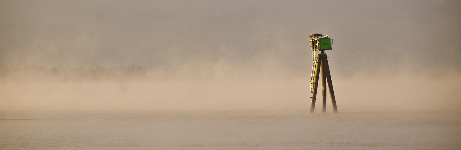
When we arrive at County Line Park in the evening, the west wind is still blowing strong. It's standing up the westbound current to form a half-mile of whitecaps between us and Quill Island, our campsite for the evening. Maria eyes the conditions and throws on her drysuit. We load our kayaks and spend a few minutes playing in the whitecaps and current. In an osprey nest built on a navigation marker, the kids have reached the awkward, teenage phase, standing awkwardly on the nest, screaming and thinking about flying. It’s low tide, so we give a wide berth to the shallow sandbar at the island’s downstream end before we pull in to camp on Quill Island’s southwest corner.
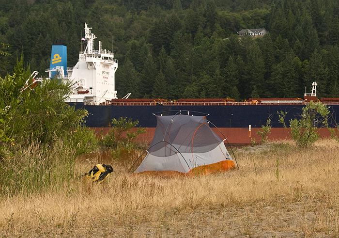
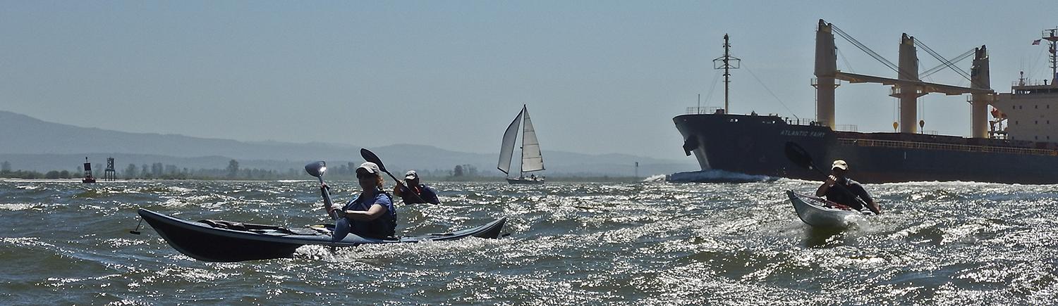
Quill Island doesn’t have a name on nautical charts, and some guidelines call it Eureka Bar. Whatever it’s called, it’s one of my favorite campsites on the river. The western beaches afford a great view downriver with a view of Eagle Cliff, and nooks offer protection from the west wind. Like most informal campsites on the lower river, fishermen and paddlers have built up makeshift wind shelters, boated in picnic tables, and made driftwood furniture. It’s “primitive camping” but of a relatively posh kind. After moving our boats well up the beach (Columbia River tides and ship wakes have been known to steal kayaks in the middle of the night) we set up camp in a spot protected from the wind, but that still offers views. The shipping channel runs between Quill and the Washington shore, and the morning river traffic includes eastbound tugs and container ships.
The next days’ forecast calls for rising winds in the afternoon. Forecasts cover large areas: by the time we launch at 9:30 the wind is already blowing near ten knots. We work our way along the cliffs on the Washington side, passing a dredging operation that’s part of the continuous process of keeping the Columbia’s shipping channel clear. Before long, the wind forces us to abandon the cliffs, crossing over to duck behind Puget Island and follow a mazelike route through the quiet channels on its northeast side.
On the east side of Puget Island is Brown Island, a natural island that’s been augmented by piling dredge spoils from the perpetual maintenance of the shipping channel. Like many of the Columbia’s dredge spoil islands, it’s defined by austere shifting sand landscapes where you half expect to see Peter O’Toole and Omar Sharif riding camels in a scene from Lawrence of the Lower Columbia. But the sand islands are home to a different, but important resident. As we paddle by, we see two of them coming down to the river to drink.
They’re small birds, Eremophila alpestris strigata, streaked horned larks, just bigger than a sparrow. They were once-common residents of the Willamette Valley and Puget Trough, but are now missing from their historical range: their native savannah habitat was swallowed by development and population growth. But a remnant population has thrived on the sandy habitat with sparse grasses created by dredge spoil islands. Since larks are ground-nesters, the islands also provide a relatively safe refuge from vehicles. While the dredge spoils provide a refuge, care must also be taken to ensure repeated dumping doesn’t make the islands unusable.
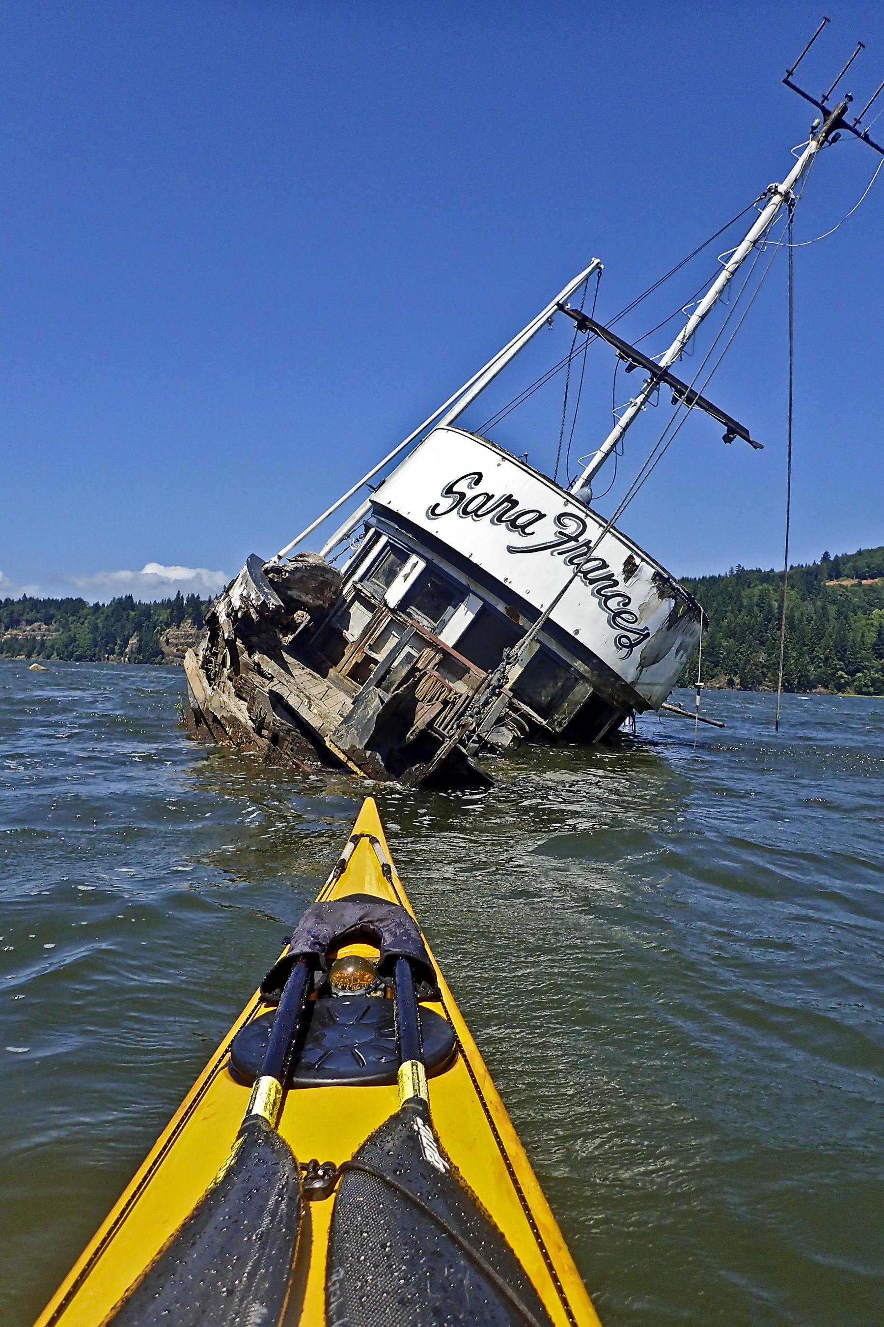
Past Brown Island, a narrow set of channels allows us a wind-free passage back to the north side of Puget, where the Sara Frances lies half-sunken near the mouth of Bernie Slough. The Sara Frances is an odd relic that’s adorned the channel for a few years, and is either too tough to move, or too damaged make salvaging worthwhile. Leaving her half-sunk in the mud, we brave the wind again, crossing back to the Washington side to visit the waterfalls.
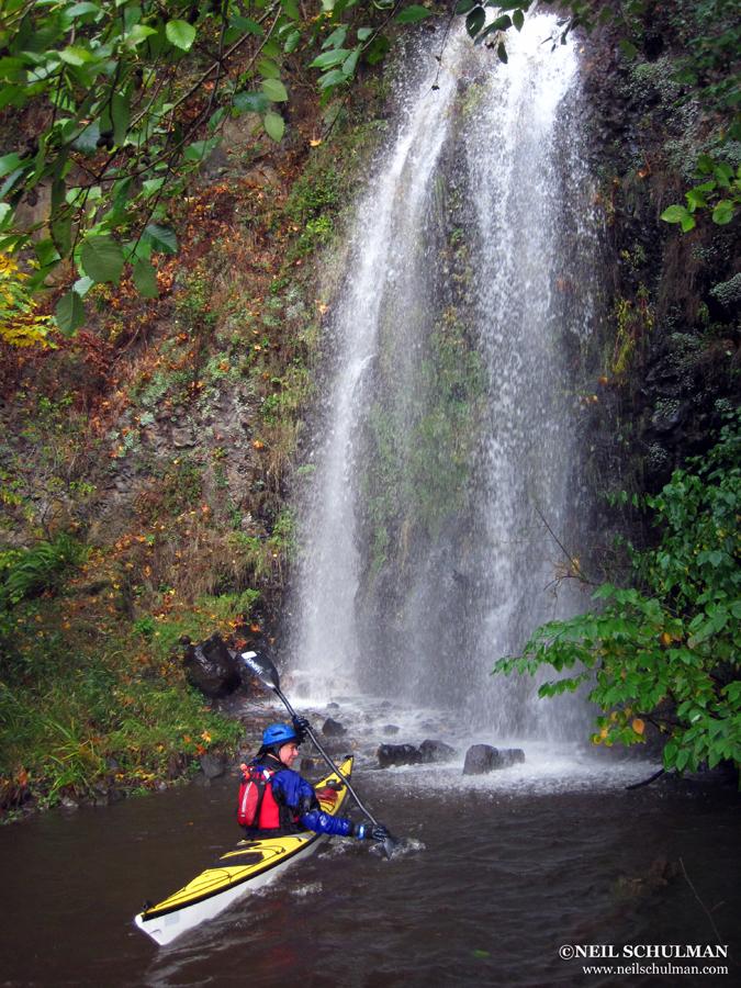
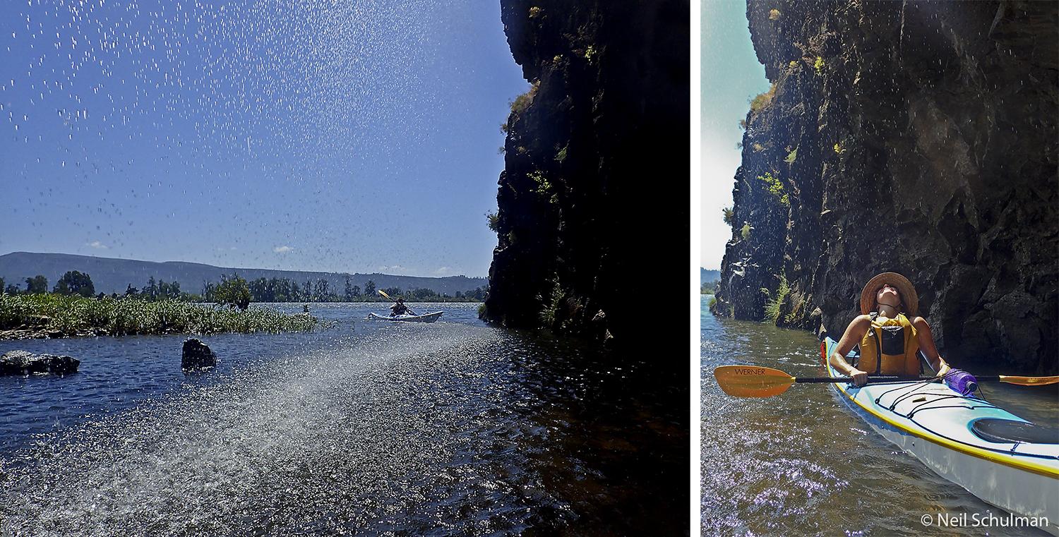
In the Lower Gorge, waterfalls plunge off the basalt cliffs into the river, invisible and unreachable by anything other than a small boat. In the winter and spring, the waterfalls are raging torrents. In this year’s hot and dry summer, they’re pleasant showers to paddle under, and the afternoon high tide gives us plenty of room for a refreshing in-kayak soak.
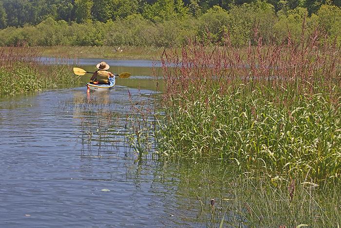
Below the Lower Gorge is the town of Cathlamet. Its waterfront sports a well-weathered mix of tugs fishing boats, and pleasure craft. At Cathlamet we also get another break from the wind, slipping behind Hunting Island into Elochman Slough, a winding passage protected from the main Columbia where in November 1805, Lewis and Clark noted that they would have gotten lost without a local guide from a Chinook village on Hunting Island. We come close to getting lost ourselves, watching our charts carefully in the mazelike channels and islands of the slough and Elochman River, before we re-enter the Columbia. Today, the slough and river are part of the Julia Butler Hansen Wildlife Refuge for the Columbia White-Tailed Deer, another species that used to be widespread but is now confined to a few areas.
Soon we’re back in the main channel, with the wind gusting fifteen knots into our faces and throwing sheets of spray off our bow. We paddle on the treadmill for a few hundred yards before we can duck again, this time into Steamboat Slough, which runs behind the shelter of Price Island and emerges three miles westward at the town of Skamokawa. When we reach the west end of Price, the wind is even fiercer: waves pile against a sandbar at the mouth of Steamboat Slough, and a tanker wake adds to the waves. Below Skamokawa, there’s no protection behind islands. Sensing discretion is the better part of valor, we pull aside on the big sandy beach at Vista Park, and haul our camping gear up the beach to a campsite, fighting the fatigue of 16 miles, much of it into the wind.
We consider waiting for the wind to die before trying to make progress further west. But it doesn’t. We listen to the forecast again, contemplating a dawn start to beat the wind. Forecasts of wind up to 25 knots in the main channel dissuade us from that too. As luck would have it, a friend of mine is camped in the next site over, and she gives me a ride to retrieve my car from County Line Park. And it’s just as well: the next day dawns both cold and windy indeed. Skamokawa’s name comes from Chinook jargon for smoke on the water: Vista Park lies in a microclimate reminiscent of San Francisco’s Candlestick Park. Cold fog pours out of the valley formed by Skamokawa Creek, creating a great morning for photography, but less ideal for paddling. Paddling west Skamokawa to Brookfield Point will wait for another day.
Why you should go: An extended journey through a part of the river only explorable by small boat, with great camping, cliffs, and waterfalls.
If you go: Plan your paddling in the early morning before the west wind rises in summer. In winter, the trip can often be done with an east wind at your back.
Distance: 16 miles from County Line Park to Skamokawa, or 11 miles to Cathlamet. A longer trip can easily be combined with side trips in many directions.
Launch and Land: County Line Park west of Longview, and Vista Park, Skamokawa. Lark Island (east of Tenasilahee) offers primitive camping. The Elochoman Marina at Cathlamet offers tent sites and yurts.
Nearby: Skamokawa Paddle Center, camping at Vista Park, lodging at The Inn at Skamokawa Landing, and food at Skamokawa’s Duck Inn or in Cathlamet.